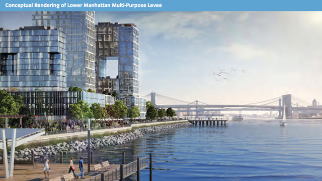
Mayor Bloomberg’s vision to protect New York from future storm surge events and effects relating to ongoing climate change may be coming closer to reality, as NYEDC is now soliciting RFPs for the planned Seaport City development, which will form a new buffer between Manhattan and New York Harbor along the island’s southeast corner – the development is described as a ‘multi-purpose levee.’
Originally unveiled earlier this summer – as part of ‘A Stronger, More Resilient New York‘ – the Seaport City project may actually be legitimate, and not just a pipe dream. New York has seen several proposals involving landfill go nowhere, including an ambitious plan to connect Governor’s Island to Manhattan – that has obviously not yet occurred. Still, much of coastal Manhattan is landfill, and past projects like Battery Park City show the idea to be feasible.
Battery Park City is an especially apt comparison in light of Sandy, which barely touched the neighborhood despite the fact that it juts into New York Harbor. According to The New York Times’ Sandy flood map, much of the neighborhood actually avoided the rise of the Hudson – and the entirety actually became a separate island at the height of the surge. Adjacent blocks of Tribeca and the Financial District were devastated, and parts of the World Trade Center site were also flooded.
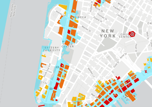
NYC Flooding During Sandy, map via The New York Times
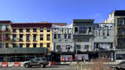
Much like the Financial District, the South Street Seaport vicinity was heavily damaged, with water rising up to ten feet. Many establishments have only just begun to re-open, as the damage was so great – the neighborhood is home to an older building stock, and many buildings power equipment was completely destroyed.
There is enormous pressure for new real estate in New York, so planning a new neighborhood that also functions as an enormous levee makes sense, and also makes storm protection more cost-efficient – though one thing the city must address is FDR Drive, which would bisect the new neighborhood from Manhattan. Making the same mistakes that have occurred with Battery Park City would be unwise, and leaving FDR Drive elevated would divide the new Seaport City, potentially creating a sterile environment.
As the new neighborhood could stretch from Battery Park to 14th Street – if the scope does follow what the initial plans indicate, as seen below – an inventive solution could put FDR at the existing shoreline, and capping it with the new neighborhood. This way, the levee could serve to protect from flooding, while also fixing traffic and re-unifying the East Side with the waterfront.
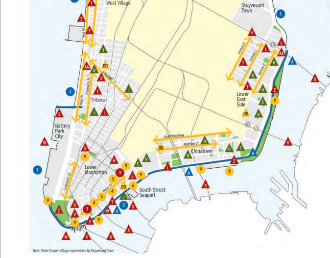
Proposals for NYC – the levee would stretch from Battery Park to 14th Street, via NYC.Gov
A truly bold move would have buildings face the harbor themselves; there is no reason seawall-quality steel could not be integrated into a facade, and a design for Seaport City that integrates its structures into a sea wall would be innovative and save an enormous amount of money, while allowing the sea wall to rise higher in the few unprotected spots between new buildings. Humans have gone beyond creating shorelines, and are now on the verge of controlling them; Manhattan would be an excellent first example.
Subscribe to YIMBY’s daily e-mail
Follow YIMBYgram for real-time photo updates
Like YIMBY on Facebook
Follow YIMBY’s Twitter for the latest in YIMBYnews

