
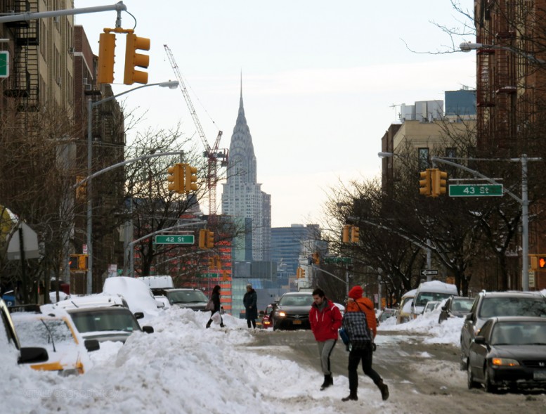
New Yorkers breathe a collective sigh of relief as the city’s second largest snow pileup on record is steadily melting away. But while snow cover is a hazard to pedestrians and drivers alike, it also offers an opportunity to make the streets safer and more pleasant.

A sneckdown. Image from Wikipedia
A sneckdown, shorthand for snowy neckdown, is a temporary curb extension caused by snow accumulation. As drivers and pedestrians navigate the obstructed street, patterns begin to form where people and cars find routes across intersections. These patterns highlight optimal paths for pedestrian and vehicular traffic. The remaining pileup indicates redundant road surface that may be transformed into curb extensions, wider sidewalks, and public plazas.
A sneckdown on Queens Boulevard
Streets contain more than 80% of public space in most cities. Optimized street design not only creates new public amenities, but, more importantly, also cuts down on avoidable death and injury that pedestrians and drivers face on an all-too-frequent basis.
According to Mayor Bill de Blasio’s Vision Zero program, being struck by a vehicle is the leading cause of injury-related death for children under 14 and the second leading cause for seniors. On average, one New Yorker is killed or seriously injured in a traffic incident every two hours. Though fatal incidents on the streets of New York fell from 701 in 1990 to 381 in 2000, and down to 271 in 2011, the deadly figures have stagnated since then. As per Vision Zero, yearly fatalities between 2011 and 2015 averaged 262 per year. WNYC’s Mean Streets tracker provides slightly higher counts for 2014 and 2015, and brings a personal touch to the statistics by listing the victims’ names. The true scope of roadside tragedies is perhaps best illustrated by Metrocosm’s map of fatal road accidents in the United States between 2004 and 2013. The brightly colored map, which almost perfectly mirrors population density, would be almost beautiful, if not for the sobering fact that every mark stands for a person that lost their life on the nation’s streets and highways during the ten-year period.
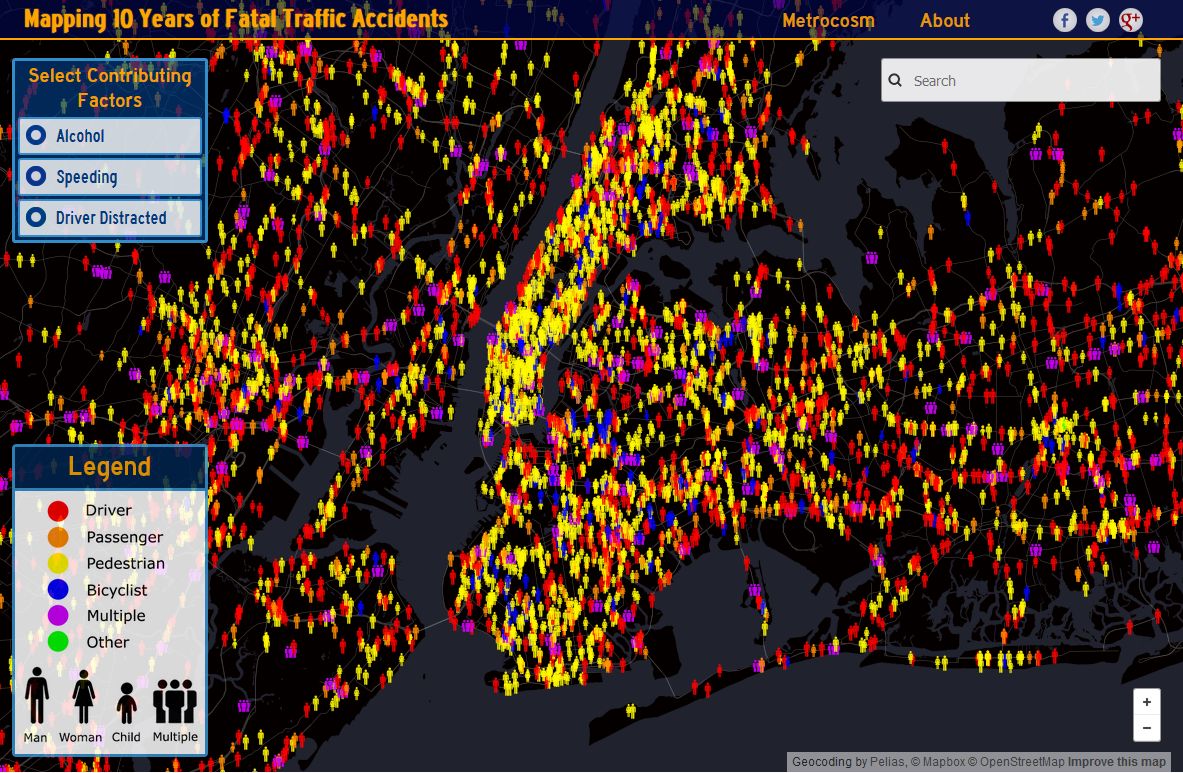
Map of traffic fatalities in the NYC area by Metrocosm
The Vision Zero map provides similar fatality data broken down year-by-year. On a happier note, it also shows types and locations of street safety features implemented throughout the city.
Road safety hinges on a multitude of factors, such as vehicle standards, speed limits, and traffic regulation, as well as built-in street features such as speed humps and leading pedestrian intervals at traffic lights. Among these factors, street layout plays an important role in its own right. Rightsizing, or creating an optimal street configuration, shortens pedestrian crossing time, cuts down on speeding, improves sightlines, and improves the driver experience by simplifying complex intersections.
A “neckdown,” the foundation term for its snow-based derivative, refers to the type of curb extension that shortens crosswalk length by extending corner curbs. Other types of curb extensions also exist, such as the pinchpoint, a mid-block extension that may slow down traffic and add public space, and the chicane, a bend designed to slow down low-volume streets that encourage speeding while increasing sidewalk width. These and other design elements are a part of a greater arsenal of strategies that are particularly important at intersections. According to the National Association of City Transportation, corners and crossings are where drivers are most likely to encounter pedestrians, and minimizing turning speeds is crucial to pedestrian safety.
Of course, all trade-offs must be considered, such as the ability of emergency and sanitation vehicles to pass through narrowed junctions, as well as the impact of losing parking spaces on neighborhood congestion.
The city’s, and possibly the country’s, most famous example of rightsizing is Broadway Boulevard, where traffic lanes were eliminated and major junctions such as Union, Madison, Herald, and Times squares were simplified to create improved crossings, new bike lanes, and large amounts of public space in some of the city’s most congested areas. According to the Project for Public Spaces, these street improvements resulted in generally shortened traffic travel times, reduction of motorist and passenger injuries by 63 percent, a pedestrian injury decrease of 35 percent, and a bicycle volume increase of 16 percent on weekdays and 33 percent on weekends.
Aside from Manhattan’s Broadway example, numerous rightsizing projects took place across the five boroughs over the past few years. One of them tackled a particularly complex intersection of Broadway and Roosevelt Avenue in Jackson Heights, Queens, next to a bus terminal and over/under a junction of the E, F, M, R trains and the elevated 7. The simplified intersection was laid out with the help of community outreach by the New York City Department of Transportation.
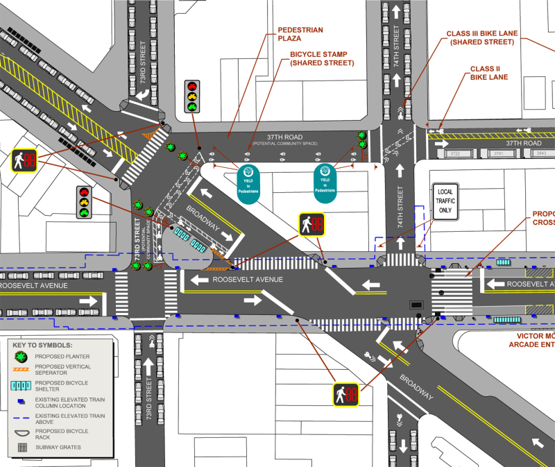
Broadway – Roosevelt Avenue street improvements as proposed by the NYC Department of Transportation

Broadway – Roosevelt Avenue after street improvements
The spread of the concept of sneckdowns is a prime example of grassroots social media efforts reversing the traditional city-community relationship paradigm. Instead of the NYC DOT actively reaching out to city residents, the residents themselves post their urban design observations to be seen by the greater community. Aaron Naparstek, Streetsblog founder and visiting scholar at MIT’s Department of Urban Studies and Planning, first posted #sneckdown on Twitter on January 2, 2014. “Urban public space is an incredibly valuable and limited commodity,” he stated, “so why do we give up so much of it to its most inefficient user – the single-person vehicle?” The concept was further expanded by filmmaker Clarence Eckerson, Jr. of Streetfilms, which focuses on short films regarding smart transportation design. The idea went viral on various forms of social media, spawning more Twitter hashtags such as #plowza, #slushdown, #snovered, and #snowspace.
The design-by-snow strategy is now widely acknowledged not only by the media, but by official agencies as well. New Jersey Department of Transportation engineer Gary Toth calls it a quicker, cheaper, and more reality-based mode of urban design than computer modeling. In 2014, the Office of Transportation Planning in Raleigh, North Carolina asked the followers of its Twitter account to send pictures of wasted space at intersections as indicated by snow. In the same year, the Boulder Transportation Advisory Board addressed the idea during an official meeting.
Though the term itself is only two years old, the concept behind it is not new. Back in 2011, Philadelphia’s Department of City Planning used snow cover to convert redundant road space into pedestrian plazas at the intersection of 48th Street and Baltimore Avenue. Although no snow-related term existed at the time, an opportunity to right-size local streets based on snow trails presented itself clearly.

Image by Prema Bupta via Streetsblog

Philadelphia’s 48th Street and Baltimore Avenue after street improvements
Going back further, in the 1980s, road planners in snowless Australia spread flour onto intersections to observe the paths formed by passing vehicles.
As snow still sits on sidewalks, Streetsblog is shining a spotlight on a social media sampling of snow-snared streets. A particularly glaring example has been spotted in Brooklyn at the crossing of Atlantic and Flatbush avenues by Twitter user Suman (@steadyblogging).
A sneckdown at the crossing of Atlantic and Flatbush avenues in Brooklyn. Original image by Suman @steadyblogging
A pileup stretches almost 50 feet into the massive and awkward diagonal intersection of two major thoroughfares. According to Metrocosm’s map, the area contains the most dangerous stretch of upper Flatbush Avenue, with three pedestrian fatalities taking place over the 10-year period between 2004 and 2013. Improving pedestrian safety at this junction is especially important given its position between Barclays Center and Atlantic Terminal. The crossing will only get more congested when new development at Pacific Park directly east will add even greater density.
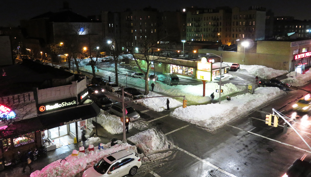
A major snowstorm can grind the city’s movement to a halt. Streets and sidewalks turn into hazard zones, curbside parking becomes nearly impossible, and pedestrians and drivers alike ditch their surface realm whenever possible and switch to the already congested subways. Though intersections become particularly dangerous, there is silver lining on the white canopy. Observing and reporting local sneckdowns allows all citizens to participate in a grassroots, crowd-sourced city planning process that not only creates additional public space, but also makes our city safer and more efficient.
Subscribe to YIMBY’s daily e-mail
![]()
Follow YIMBYgram for real-time photo updates
Like YIMBY on Facebook
Follow YIMBY’s Twitter for the latest in YIMBYnews
The concrete neckdowns make turns difficult for deliver trucks and much more importantly fire engines. Painted neckdowns with ‘No Standing Anytime’ signs are a safer option. The ‘neckdown’ on New Dorp Lane & 8th Street is a constant problem.
Fascinating stuff