
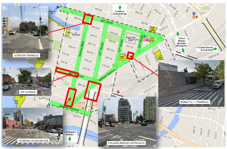
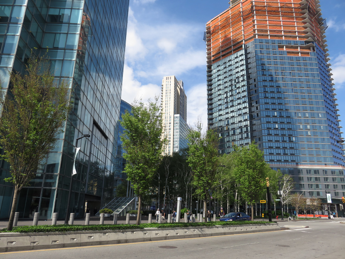
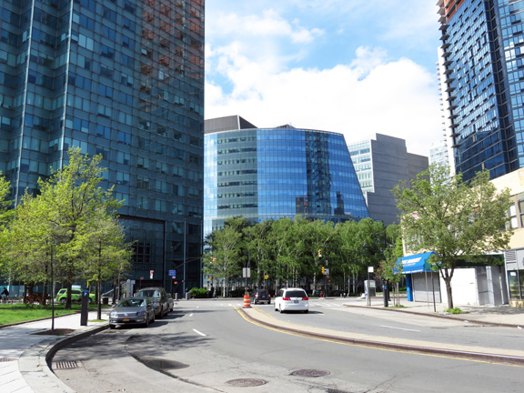
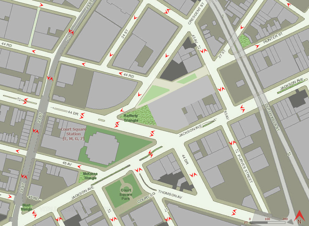
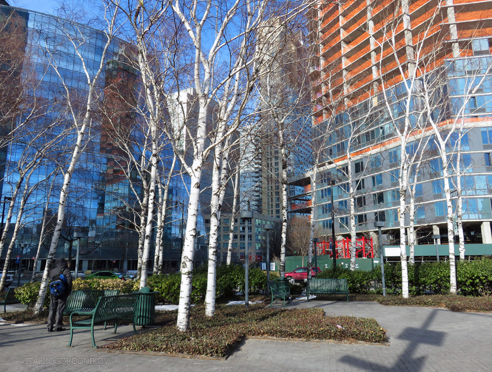
The ongoing transformation of Long Island City is astounding. In the decade between 2006 and 2015, more than 8,600 housing units have been completed in the area, with well over 22,000 more on the way. Between 2012 and 2015, prices for prime development sites have jumped by 269 percent. As the neighborhood rapidly transitions from commercial/industrial to high-density residential, the local street grid, characterized by odd angles, must undergo a significant transformation. The city government began to address this need in 2010, when Jackson Avenue, the area’s principal thoroughfare, was upgraded with a green median, while a small triangular park was created at the intersection of 27th Street, Hunter Street, and 43rd Avenue.

Jackson Avenue median. Looking east from Thomson Avenue intersection.
Next on the agenda is a thorough, $38.47 million, neighborhood-wide street reconstruction, focused on the southern portion of Long Island City. In December 2015, the Department of Transportation outlined basic street right-sizing strategies, grouped the streets via basic types/hierarchies, established a set of approaches for each type, and highlighted areas of particular concern.
A February 2016 presentation presented more specific proposals. The latest presentation, released on May 3, provides a comprehensive overview of the scope considered so far, although the proposals are still far from final. Common street design elements lie at the core of the redesign. Gateways, or neckdowns, make street crossings safer by decreasing crossing length.
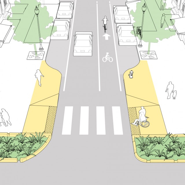
A gateway/neckdown. Source: National Association of City Transportation Officials (NATCO)
Gateways are a form of curb extensions, which may extend beyond the crossing to increase sidewalk width.
Curb extension. Source: NATCO
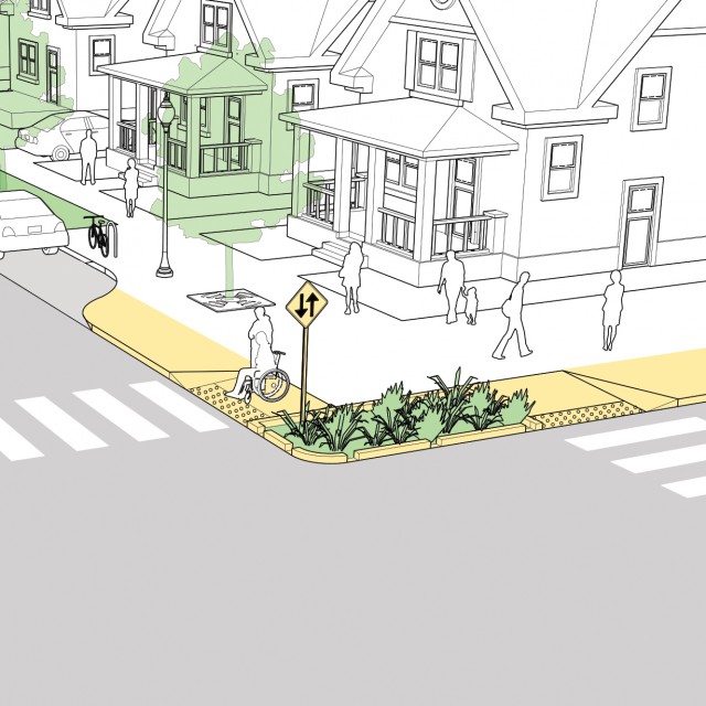
In the proposal, curb extensions would be widely used at crossings on local streets throughout the neighborhood. Tree plantings, which have significant benefits to residents’ health and well-being according a 2015 study, would line the blocks that are currently vegetation-free.
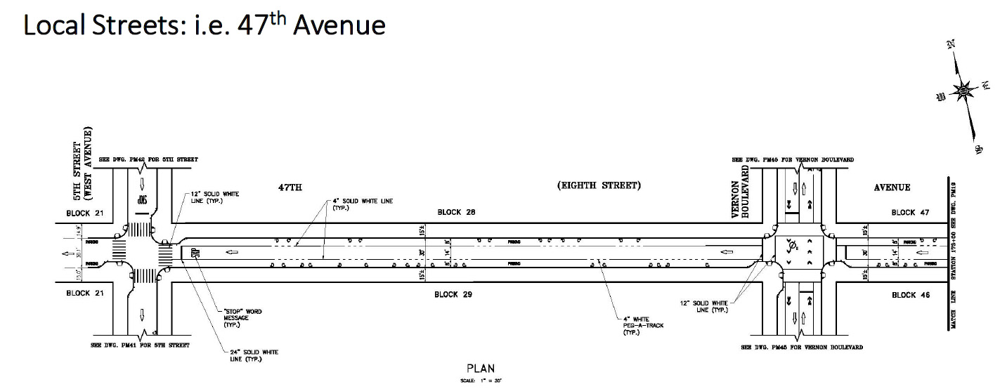
Typical local street redesign. Source: NYCDOT, May 2016
The existing green median along Jackson Avenue would be extended southward, with a possible introduction of bike lanes.
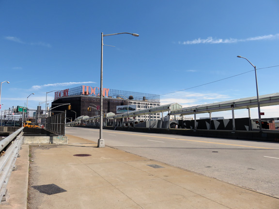
Street realignment and introduction of new public space would take place at the particularly complex intersection at the foot of the Brooklyn-bound Pulaski Bridge, where a protected bike lane opened on April 28.
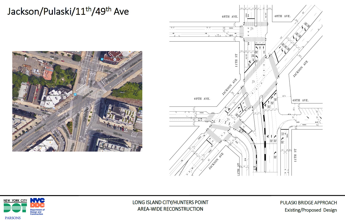
NYCDOT-2016-05-Slide-10-Pulaski
A simplified layout was outlined for the southern terminus of Jackson Avenue and Vernon Boulevard by the Vernon Blvd-Jackson Av station of the 7 train.
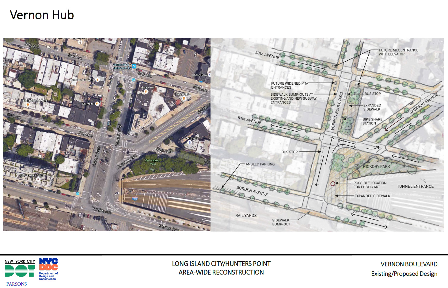
Source: NYCDOT, May 2016
The tiny, redundant street segment in front of the MoMA PS1 museum on Jackson Avenue would also be converted into a plaza, expanding the existing pocket park to roughly twice the size.

Source: NYCDOT via Streetsblog
A minor expansion of pedestrian space would take place at the Gordan Triangle, at the crossing of 44th Drive, 10th Street, 45th Avenue, and Vernon Boulevard.
Additional street improvements, such as green medians, bike lanes, etc., are proposed for thoroughfares such as 44th Drive, 11th Street, 21st Street, 23rd Street, and more.
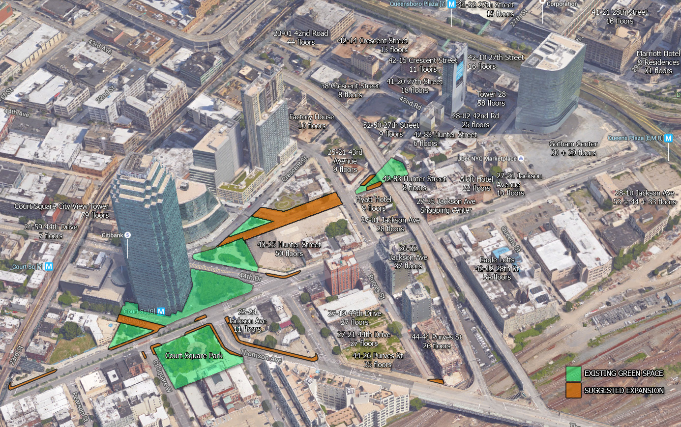
New York YIMBY Suggestions: Court Square area
The one area lacking almost any improvement is Court Square itself, where Jackson and Thomson avenues, 44th Drive, and other streets form a complex, multi-block interchange at the center of the neighborhood. The DOT has addressed the interchange with a single new crosswalk.

Street improvement at Thomson Ave and 44th Drive as proposed by the Department of Transportation. Source: NYCDOT, May 2016
Site of proposed crosswalk
We at New York YIMBY feel that the site allows for many more possibilities.
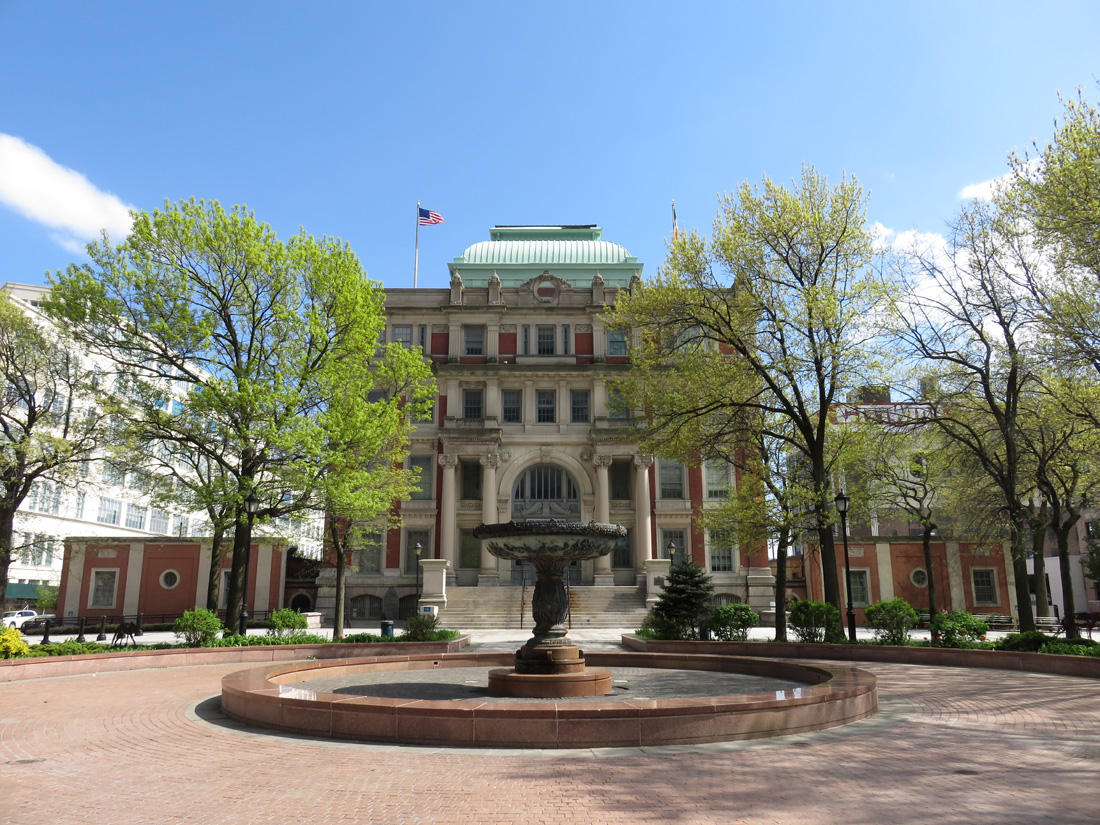
The Court Square Park has been a focal point of Queens ever since October 22, 1872, when the City of New York purchased the land for the Queens County Court House and the park. However, the park has not always had its square shape. In the 1950s, a diagonal segment of Thomson Avenue was de-mapped in order to to extend the park to its current size. This started a trend of re-configuring redundant street sections, common within the local street grid, into public space. Today, a string of disjointed green spaces lines the adjacent blocks, separated by streets ranging from small, barely used alleys to multi-lane, traffic-jammed thoroughfares. We see the neighborhood street realignment as a prime opportunity to make the next adjustment to this crucial junction. Timing is particularly important, since tens of thousands of new residents are scheduled to move on to the surrounding blocks in the coming years.
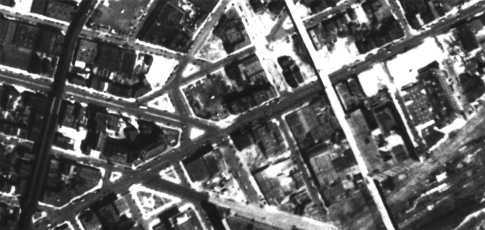
Court Square District in 1951. Source: NYC.org

Court Square District in 2012. Source: NYC.org
Court Square Park. Looking south.

Court Square Park. Looking north towards One Court Square.
Looking north across Jackson Avenue towards the plaza by One Court Square.
The following is an overview of our streetscape improvement suggestions, which are explained below. White labels indicate the ongoing construction projects in the vicinity.
Graphic by the author. Image underlay source: Google
Part 1: Court Square Junction
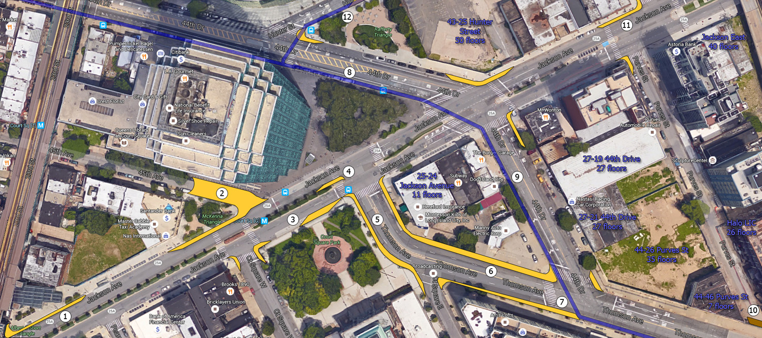
Graphic by the author. Map underlay source: Google
1) Albert F. Short Triangle – Curb expansion – Added public space: 1,100 sq ft
While the addition of the enclosed connector at the Court Square station complex, going from the underground E, G, and M trains to the elevated 7 train, was much-needed, it cut the amount of public space at the plaza in half. Widening the curb along a 140-foot stretch by the park would not only make the plaza by the congested interchange more welcoming, but would also ease pedestrian circulation along Jackson Avenue between Court Square and the area around MoMA PS1 to the east.
2) McKenna Plaza at 45th Avenue – Partial street closure and curb expansion – Added public space: 4,500 sq ft
In our suggestions, we generally try to avoid eliminating traffic lanes, let alone closing streets. However, the benefits of converting the eastern terminus of 45th Avenue into pedestrian space may outweigh the drawbacks. The block of 45th Avenue between Jackson Avenue and 23rd Street, beneath the 7 train, is a minor traffic conduit, which does not even connect to both directions of Jackson Avenue. The eastern half of the block in question passes between the plaza by One Court Square and the McKenna Triangle, while the western half runs between the Court Square Library and commercial rowhouses. The western half would be converted into a cul-de-sac, providing vehicular access to the businesses on the south side. The roughly 110-foot-long eastern half of the 30-foot-wide street would be closed to traffic. This move would connect the plaza by Court Square with the McKenna Triangle into a continuous, 155,000-square-foot space, providing a green focal point in the middle of the busy district, on top of its key transit hub. The plaza would also be used by local library patrons, while the adjacent businesses at 45th Avenue would benefit from an increased pedestrian presence. The rest of 45th Avenue west of 21st Street runs through a low-density rowhome neighborhood, passing across the Hunters Point Historic District one block west and the John F. Murray Playground beyond. The new public space would serve as a traffic-calming measure for the park-adjacent portion of the street two blocks west.
3) Court Square Park promenade – Curb expansion – Added public space: 700 sq ft
The existing curb extension at the northeast corner of the park would be extended westward, shifting the current bus stop to the western half of the block. The expansion would provide a better connection between the grand promenade of the Court Square Park to the crosswalk at Jackson and Thomson avenues, which is the principal pedestrian connector between the green spaces on either side of the avenue.

Looking east from the suggested new site of the bus stop
4) Jackson-Thomson avenue intersection – Traffic island expansion
This crosswalk serves as the principal connector between two of Court Square district’s largest green spaces. Presently, the left lane of westbound traffic at the crossing turns left. The remaining two lanes very briefly turn into three lanes on the west side of the intersection, and merge back into two lanes less than half a block away. Our suggestion would expand the traffic island while maintaining the two lane configuration.
5 thru 7) Thomson Avenue – Curb expansions – Added public space: 7,500 sq ft
Thomson Avenue is a significant thoroughfare as it carries traffic across Sunnyside Railyards. At the Court Square side, it splits into Thomson Avenue and 44th Drive, leading to angled, wide crossings and oversized lanes approaching 20 feet in width. Our proposal would expand the narrow sidewalk at Court Square Park’s eastern edge by eliminating curbside parking (5), while similar moves on the other side of the block (6 and 7) would shorten the Thomson Ave-44th Drive crossing without sacrificing any lanes. Increased pedestrian safety at this busy junction would be particularly important once the thousands of units under construction along 44th Drive are finished in the coming years. The key traffic conduit east of the intersection would remain unaffected.
Looking northeast along Thomson Avenue. Area 5 on the left, Area 6 on the right
Looking west along Thomson Avenue. Area 6 on the left, Area 7 in the background center
8) 44th Drive north of Jackson Avenue – Protected bike lanes
Curbside parking forms a physical barrier between the fast-moving traffic on the street and the pedestrians on the sidewalk. If the positions of the bike lane and parking at 44th Drive were switched, bicyclists would be afforded the same protection without the introduction of extra street barriers. According to the Department of Transportation, protected bike lanes diminish cyclist injuries by more than a third.
44th Drive. Looking east.
9) 44th Drive south of Jackson Avenue – New bike lanes
At the moment, the bike lane mentioned in suggestion no. 8 ends at Jackson Avenue, near the Citi Bike station by One Court Square. Beyond that point, cyclists have to compete with traffic on their way to the other side of the railyards, making the busy bottleneck more hazardous to themselves as well as the motorists. A block-long extension of the existing bike lane would make the passage much safer for everyone involved, without eliminating any traffic lanes. As per the DOT, pedestrian injuries have fallen 22 percent on Manhattan’s streets with recently introduced protected bike lanes. Even local businesses stand to benefit from the improvement, according to a study that suggests that retail sales on streets with protected bike lanes have grown faster than on comparable streets without bike lanes.

44th Drive. Looking north.
A dedicated bike lane would be much more difficult to introduce past the Thomson Ave-44th Drive intersection, so perhaps a shared lane might be established beyond that point.
10) Purves Street cul-de-sac – Pedestrian staircase
Purves Street runs for one block from Jackson Avenue to the north to the concrete wall of the Thomson Avenue overpass to the south. Over the past ten years, the west side of the street was transformed from a string of warehouses into a row of residential high-rises. Ongoing development on the other side of will take apartments to even greater heights, bringing thousands of new units to four buildings ranging from 7 to 35 stories. The soon-to-be densest residential block in all of Queens currently has only one point of access. A staircase running along the concrete wall at the south end of the street would provide another point of access, saving a 1,500-foot detour for the southbound pedestrians and shortening walking distance to Court Square Park by 400 feet.
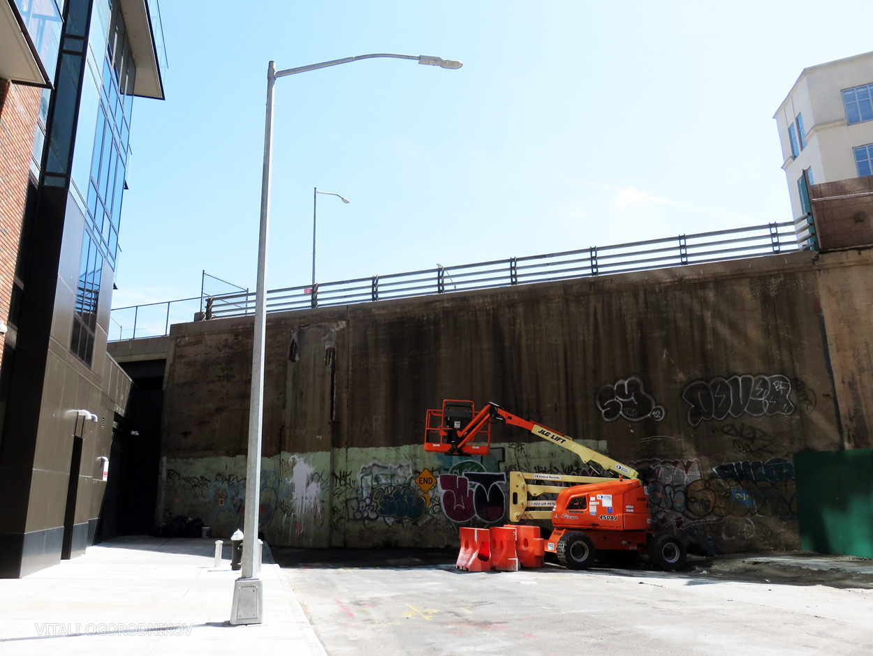
Current conditions
A quick sketch showing our suggestion
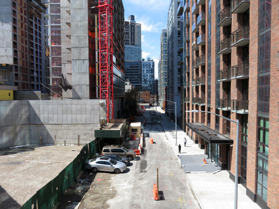
Purves Street. Looking north from Thomson Street Viaduct.
Landing for the suggested staircase.
11) Jackson Avenue-43rd Avenue-Purves Street intersection – Partial curb extension – Added public space: 600 sq ft
The 75-foot-long sidewalk extension along the off-center, triple street intersection would shorten crossing distance across Jackson Avenue at Purves Street, and would make for a wider connector to 43rd Avenue, which leads into the neighborhood’s interior and toward the waterfront.
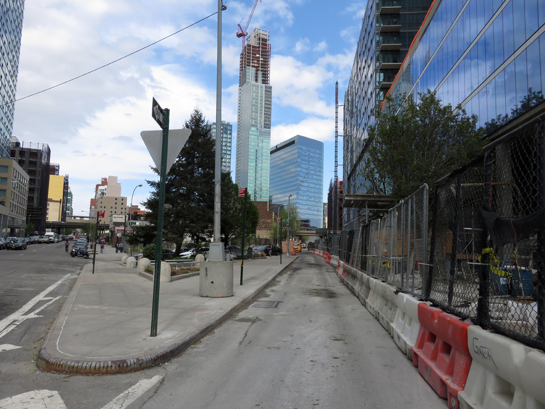
12) Hunter Street
At the moment, there is no dedicated bike lane between the neighborhood’s two focal points at Court Square and Queens Plaza. Introducing one along Hunter Street, starting at the existing bike lane along 44th Drive, is one of the many possibilities for the street, which are elaborated upon below.
Part 2: Hunter Street Promenade
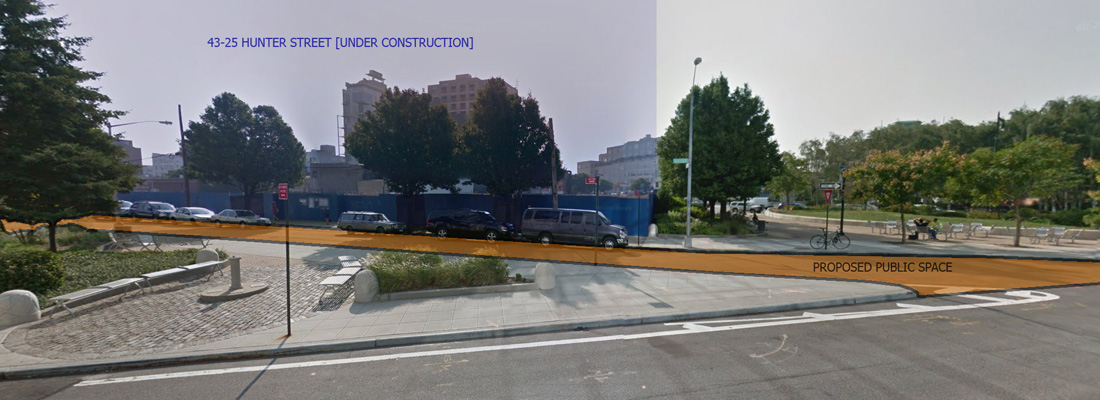
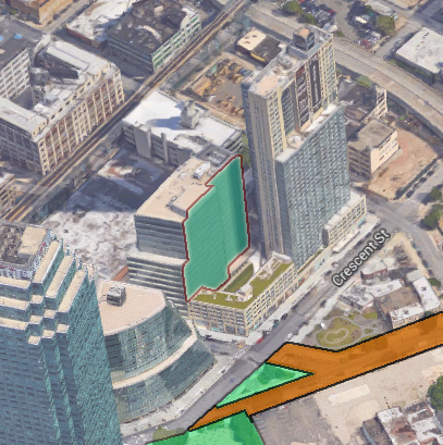
The single greatest opportunity for creating new public space from redundant road surface lies along a block-long stretch of Hunter Street between Crescent Street to the west and 43rd Avenue to the east. It sits a block north of Jackson Avenue, between Rockrose Development’s 974-unit 43-25 Hunter and the City University of New York’s law school. We touched upon the concept in two previous articles. The block-long stretch of the one-way street became almost entirely obsolete as a point of vehicular access after all the properties on the south side were replaced by Rockrose’s project. Converting the space into a plaza would eliminate two intersections and simplify two more, while adding over 17,500 square feet of public space to the dense neighborhood. Given the road’s negligible role as a traffic thoroughfare, the negative effect upon local congestion would be minimal. The Hunter Street Promenade would connect the currently disjointed public squares into a continuous, quarter-mile-long arcade, and would be made particularly effective in conjunction with the street right-sizing suggestions outlined in part 1.
Vehicle access to 43-25 Hunter Street would be provided via driveways that would traverse the shortest possible distance to the nearest streets. Access to the single remaining loading bay on the north side of the promenade may also be included, unless the building’s owners choose to rely on 43rd Avenue access. The driveways would be minimally intrusive if articulated as shared space, used by pedestrians whenever the loading bays are not being accessed by vehicles. The reclaimed plaza may be configured in many ways, whether as a quiet, verdant enclave, or as largely open space suited for community gatherings. Seasonal events, whether independently organized or coordinated with nearby institutions, may be held at this “public backyard.”

Proposed Hunter Street Promenade. Map underlay source: NYC.org
Adjacent streets provide adequate traffic access. Map underlay source: NYC.org
Looking south from Crescent Street. September 2013. Image source: Google
Western terminus
Eastern terminus
Addressing the Public Realm Through Private Initiatives
Lastly, we would like to venture from street redesign towards conceptual approaches in a somewhat different direction.
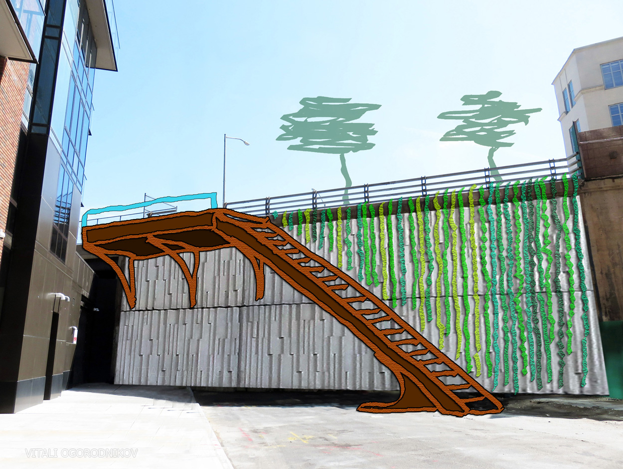
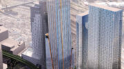
In 2006, Court Square Place, a 16-story, 274,433-square-foot office building at 24-01 44th Road rose two blocks north of the One Court Square tower. Its floor-to-ceiling windows face west toward the Midtown skyline, while the lot to the east is addressed with a 241-foot-high blank wall. Though there are a number of blank lot walls across the neighborhood, we can expect most to be blocked by future development. Here, however, the adjacent property was developed in 2013 with the 709-unit Linc LIC. Rockrose Development’s project took up the remaining three-quarters of the block and brought much-needed density and activity to the Court Square interior. The 41-story tower, the borough’s tallest residential building at the time, paved the way for the ongoing residential skyscraper development in the neighborhood. The architect shifted the bulk of the building to the north, presumably to take advantage of skyline views. A low-rise wing of Linc LIC sits at the site’s south portion, beneath the concrete wall of Court Square Place. Thus, the blank wall remains exposed and highly visible. As far as blank surfaces go, the wall is articulated rather well, with horizontal bands adding a sense of scale and stone finishes providing texture. Still, there is an opportunity to turn the expanse into an eye-catching installation, which may have the potential to become an icon for a neighborhood still seeking an identity. The most appealing, though the most expensive, option would be a vertical garden. While a green wall of such proportions would be a landmark of sustainability, the surface may alternatively serve as a canvas for an art installation. Since either intervention would require considerable co-operation and investment on behalf of the owners of both buildings, we see this as more of an exercise in conceptual activating our built environment, with shares its goal of engaging the public realm with the street improvement program.
YIMBY suggestion. Graphic by the author. Image underlay source: Google

The blank wall as seen from the courtyard of Linc LIC. Source: Rockrose
Looking north from the plaza by One Court Square
Subscribe to YIMBY’s daily e-mail
![]()
Follow YIMBYgram for real-time photo updates
Like YIMBY on Facebook
Follow YIMBY’s Twitter for the latest in YIMBYnews
Better zoning and architecture should have prevented the giant green wall from remaining.