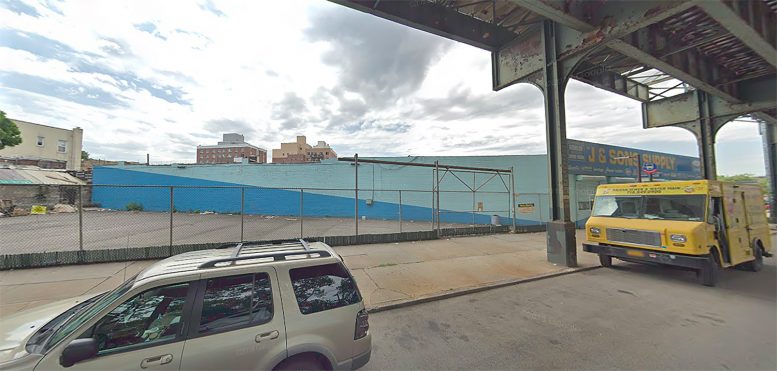
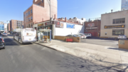
Permits have been filed for a 17-story mixed-use building at 51-22 Roosevelt Avenue in Flushing, Queens. Located between 51st Street and 52nd Street, the corner lot is steps away from the 52 Street-Lincoln Avenue subway station, serviced by the 7 train. Peng Li under the HW LIC ONE LLC is listed as the owner behind the applications.
The proposed 190-foot-tall development will yield 63,658 square feet, with 62,158 square feet designated for residential space and 1,500 square feet for commercial use. The building will have 90 residences, most likely rentals based on the average unit scope of 690 square feet. The concrete-based structure will also have a cellar and 63 enclosed parking spaces.
Studio C Architects is responsible for the design.
Demolition permits have not been filed as of yet. An estimated completion date has not been announced.
Subscribe to YIMBY’s daily e-mail
Follow YIMBYgram for real-time photo updates
Like YIMBY on Facebook
Follow YIMBY’s Twitter for the latest in YIMBYnews

That’s not Flushing, it’s Sunnyside.
Actually, it’s Woodside if you want to get technical.
Point taken. It’s kind of on the border but if you lived in that area you would probably call it Woodside. What it isn’t is Flushing.
Because claiming it is being developed in Flushing may potentially demand Flushing price per square footage. I kid.
Someone get Vanesa a map! She is consistently wrong with the neighborhoods.
For a while YIMBY was making corrections but not anymore. I guess they don’t consider accuracy to be important when it comes to development.
Paul Graziano
LT | May 1, 2019 at 9:52 am | Reply
Someone get Vanesa a map! She is consistently wrong with the neighborhoods.
To be technical, Woodside is part of Flushing. So this is correct.
It’s on the border of Woodside and Sunnyside but it is not anywhere near Flushing. Both neighborhoods are not part of Flushing. This is not correct. It is a different zip code, community board, and it is geographically separated from Flushing by all of Jackson Heights, Corona, Flushing-Meadows Corona Park and the Flushing River, which is the historical boundary of Flushing. No one ever considered this part of Flushing any time, ever.
I understand that. I said technically. Per the US post office, this is Flushing. All 113– zip codes are. As an actual community, it’s different. Just like Astoria is part of LIC. You’re welcome.
-A native
BUILD THE WALL
Yes build the wall !!!! Around your mouth!!
NO COLLUSION
Perhaps Russian bot DT is still talking
–despite his walled mouth–
because it’s all coming from his arse!
You don’t need the Wall, you have the Elevated trane.
This is utterly wrong.
Woodside is part of the Flushing POST OFFICE zip code system, period. The zip codes in Queens are divided into 4 main Postal Zones: Long Island City, Flushing, Jamaica and Floral Park.
That’s as far as the technical argument goes. It’s like saying that Fort Greene and Mill Basin are Brooklyn and the Lower East Side and Inwood are Manhattan.
Technically, Woodside and Sunnyside were part of the Town of Newtown which covered most of western Queens until consolidation of New York City in 1898. Newtown was lumped together with Flushing when they created the postal zones.
PLEASE try not to be lazy about neighborhood descriptions? It does a serious disservice to your blog.
Paul Graziano
LICYIMBY | May 1, 2019 at 11:00 am | Reply
To be technical, Woodside is part of Flushing. So this is correct.
Utterly, indeed…BUT you forgot The Rockaways…”116″ zip codes.
Paul, I’m on the same page, but I would argue that it’s worse than that … “It’s like saying that Fort Greene and Mill Basin are Brooklyn and the Lower East Side and Inwood are Manhattan.” The postal zones route mail through the nearest distribution point. This is like saying Astoria is technically part of Albany because Albany is the State capitol. Calling Mill Basin ‘Brooklyn’ isn’t wrong but calling Astoria ‘Albany’ would be entirely wrong, as is calling any neighborhood that is part of a greater post office district by it’s distribution point. I grew up in Douglaston, also part of the Flushing postal zone, and it couldn’t be more different than this address in Woodside. Point is, it would be less egregious to call North Flushing or parts of College Point simply “Flushing” (or me initially calling this Sunnyside)though there may be technically a better answer. On a site that has “back yard” in it’s title, you ought to know where your back yard actually is. It’s lazy — all it would take is a search in a google map, really. It does a tremendous disservice.
You are all wrong. Neighborhoods are not technical administrative boundaries. They are defined by those who live/work in them, informally. This is in CD 2, Queens County, New York City. You want to call it Sunnyside or Woodside, go for it. There are Neighborhood Tabulation Areas (NTAs) and this property is barely within the HP/Sunnyside/West Maspeth NTA, just west of the Woodside NTA. However, NTAs are only used for reference and are not formalized.
I JUST WANT TO SAY THAT I HAVE THE BEST PEOPLE AND THEY WOULD BE AMAZING AT FIGURING THESE TYPES OF ISSUES OUT, NO ONE IS BETTER AT SOLVING PROBLEMS THAN ME. TRUST ME I SOLVE A LOT OF PROBLEMS IM THE BEST AT IT. ALL MY FRIENDS HAVE PROBLEMS AND I SOLVE THEM, AND I HAVE SOME TRULY GREAT FRIENDS. WE NEED SOMEONE TO GET TO THE BOTTOM OF THIS WHO WROTE ‘THE ART OF THE DEAL’ . HUGE
Sam – while it is true that neighborhoods are not technical administrative boundaries in New York City, in Queens in particular, neighborhoods are based on former city, town and village boundaries. Most haven’t changed too much during the past century. And, it is particularly egregious to call Sunnyside, Woodside or Maspeth – all in relatively close proximity and adjacent to each other – Flushing (which is 5 miles away and a completely different part of the borough) solely based on a zip code that groups neighborhoods with the Flushing P.O, which stretches from Woodside to Douglaston. That’s lazy research, if you can even call it that.
In addition, many people rent, buy or live in a neighborhood based on what that neighborhood is – remember the 3 L’s? Location, location, location.
Posting a development that’s in Sunnyside or Woodside and saying it’s in Flushing doesn’t make sense.
And Erich – what you said, double-down.
Paul Graziano
Sam | May 2, 2019 at 12:23 pm | Reply
You are all wrong. Neighborhoods are not technical administrative boundaries. They are defined by those who live/work in them, informally. This is in CD 2, Queens County, New York City. You want to call it Sunnyside or Woodside, go for it. There are Neighborhood Tabulation Areas (NTAs) and this property is barely within the HP/Sunnyside/West Maspeth NTA, just west of the Woodside NTA. However, NTAs are only used for reference and are not formalized.
Paul the origination narrative is quite correct. But it doesn’t make your conclusions correct. There are zero neighborhoods formally defined by law. Zero. Zip. I actually know you. Ill bring it up next time i talk to you.
It’s missing the point if you are arguing the legality of a neighborhood. We’re all well aware that the city doesn’t really formally have neighborhood boundaries. There are overlapping interests, legal, political, and monetary, that muddy the whole thing up. So much so, that in fact the colloquial terms for neighborhoods often shift. Where is the boundary between Greenpoint and Williamsburg, for example? Real Estate trends seem to have moved it in my lifetime. The problem here is that the article is using a colloquial reference to an area that is completely wrong, it is one that anyone in the areas at issue would find confusing. Good journalism is not supposed to confuse people. Perfect example: I said “Sunnyside” in my initial post. The boundary is so clearly defined by consensus that when I looked at a map I realized I would have been more correct if it was on the other side of the street. It was close enough that people knew what I meant, but the line is so clear in people’s minds that a good reporter would know the difference. You have to skip over two large, densely populated neighborhoods, Jackson Heights and Corona, and one of Queens’ largest parks to get into what 99.99 percent of the population of Queens would consider Flushing even if you don’t know what side of the street you are on. If we’re arguing legality, all the posts in Queens should just say Queens. By using neighborhood names in titles of articles, the reporter is consenting that there is value in using a neighborhoods colloquial name, so be accurate.
I don’t see why any development would not want to be associated with the name Flushing.
It ranks right up there with Sewer Idaho and Septic Tank Kansas.
Jesting aside, Flushing is a diverse, prosperous & growing neighborhood in NYC with a proud history:
According to Wokipedia, on October 10, 1645, Flushing was established on the eastern bank of Flushing Creek under charter of the Dutch West India Company and was part of the New Netherland colony. The settlement was named after the city of Vlissingen, in the southwestern Netherlands, the main port of the company. However, by 1657, the residents called the place “Vlishing.” Eventually, “Flushing”, the British name for Vlissingen, was used. Despite being a Dutch colony, many of the early inhabitants were British.
Unlike all other towns in the region, the charter of Flushing allowed residents freedom of religion as practiced in Holland “without the disturbance of any magistrate or ecclesiastical minister.” However, in 1656, New Amsterdam Director-General Peter Stuyvesant issued an edict prohibiting the harboring of Quakers. On December 27, 1657, the inhabitants of Flushing approved a protest known as The Flushing Remonstrance. This petition contained religious arguments even mentioning freedom for “Jews, Turks, and Egyptians,” but ended with a forceful declaration that any infringement of the town charter would not be tolerated. Subsequently, a farmer named John Bowne held Quaker meetings in his home and was arrested for this and deported to Holland. Eventually he persuaded the Dutch West India Company to allow Quakers and others to worship freely. As such, Flushing is claimed to be a birthplace of religious freedom in the New World.
According to Wikipedia too!