
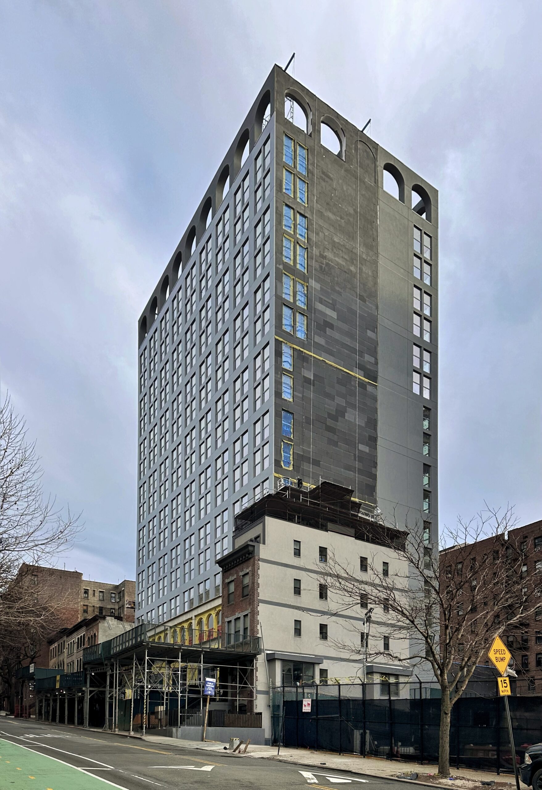
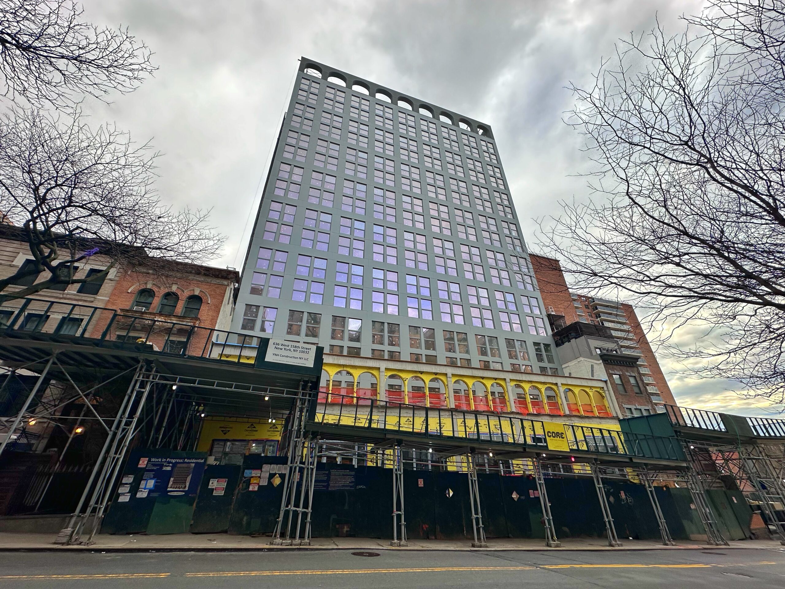
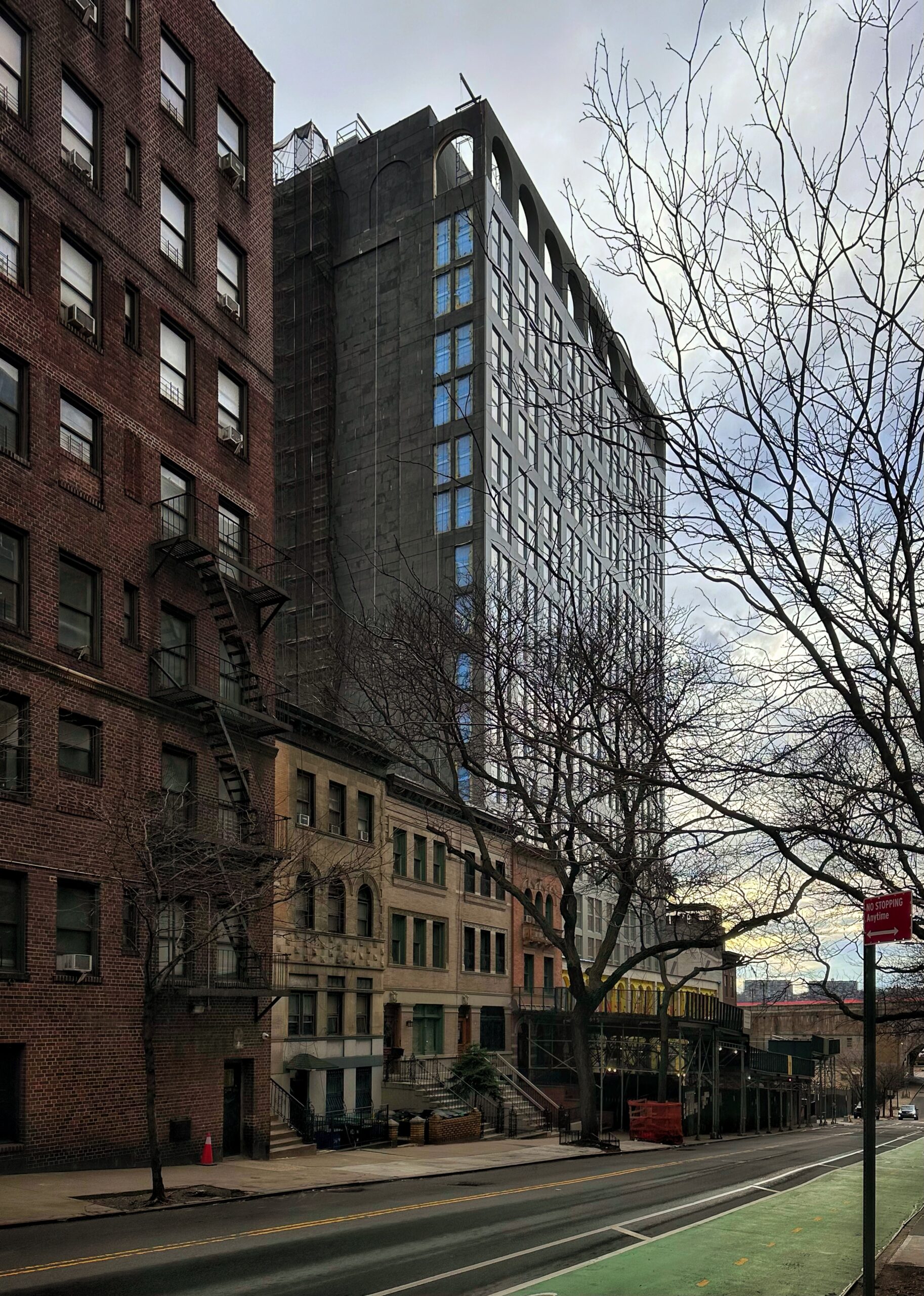
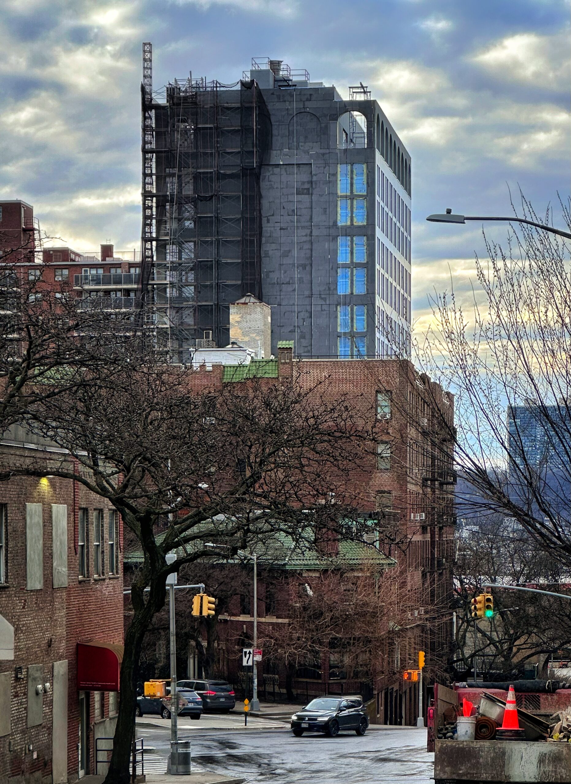
Construction is nearing completion on 638 West 158th Street, a 17-story residential building in Washington Heights, Manhattan. Designed by Morris Adjmi Architects and developed by Javier Martinez of Artifact Real Estate Development Company, the 197-foot-tall structure will span 118,559 square feet and yield 120 rental units with an average scope of 927 square feet. The project will also include 7,221 square feet of community facility space, a cellar level, a 30-foot-long rear yard, and a 51-vehicle parking garage. The property is located between Riverside Drive and Riverside Drive West.
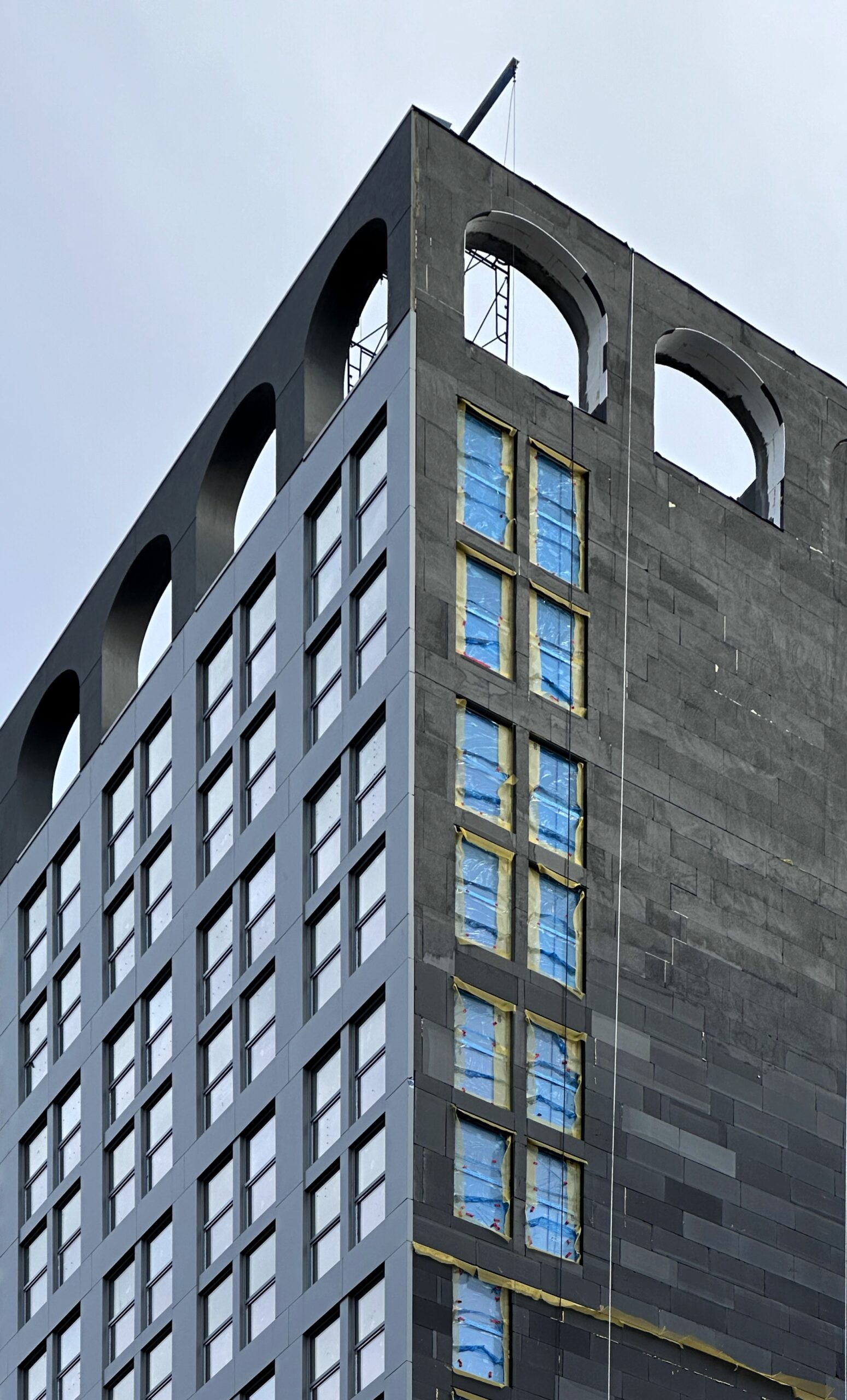
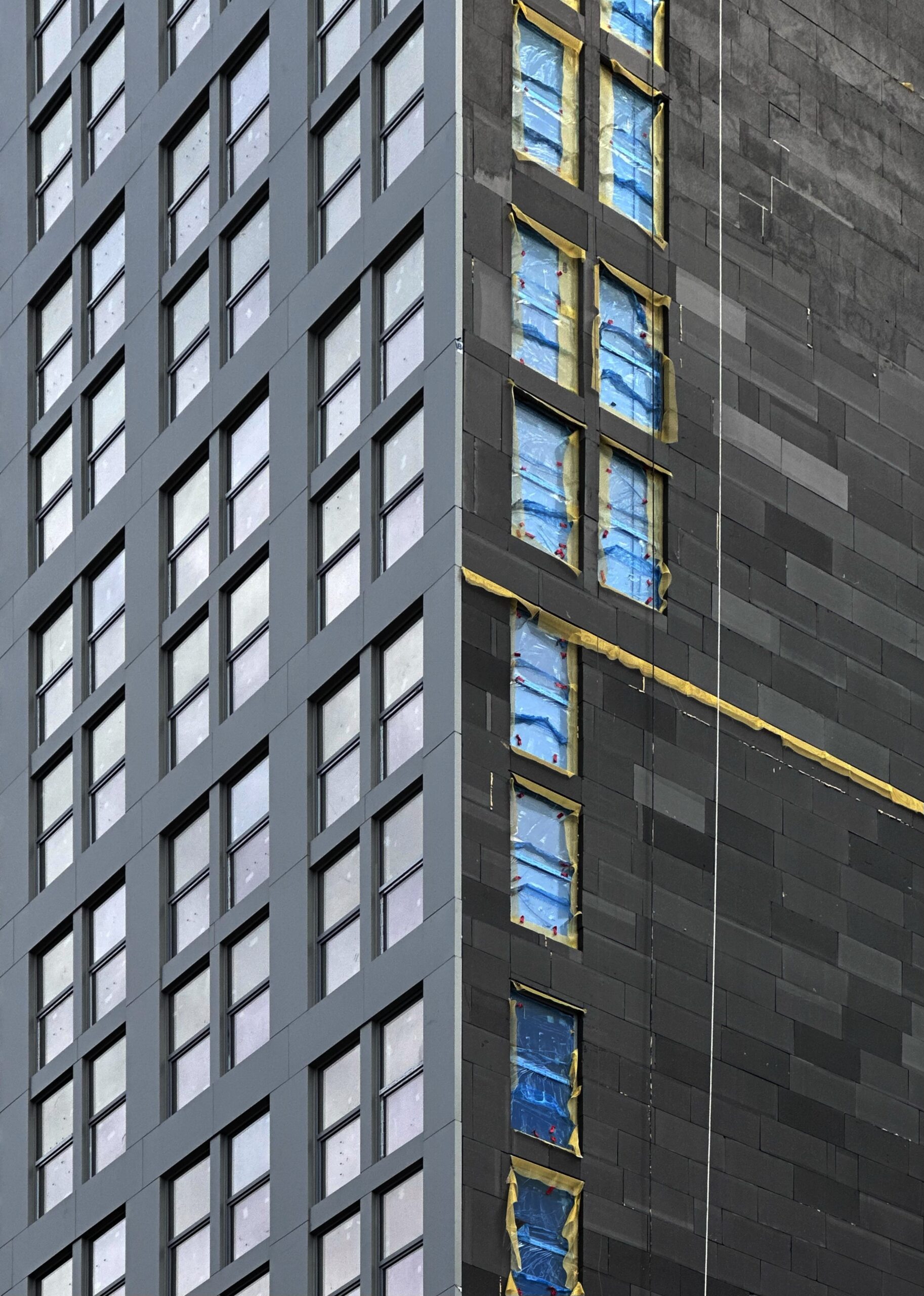
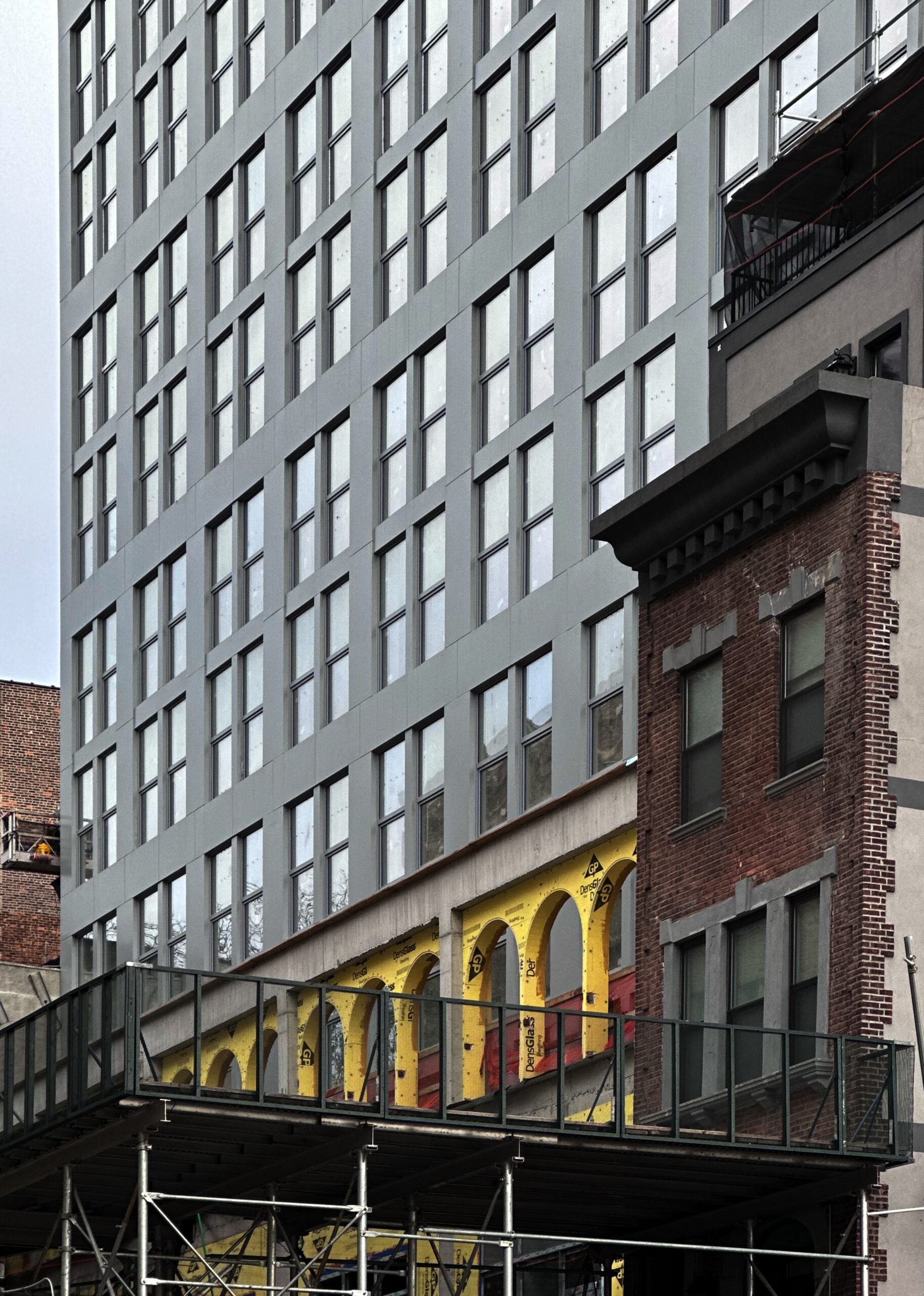
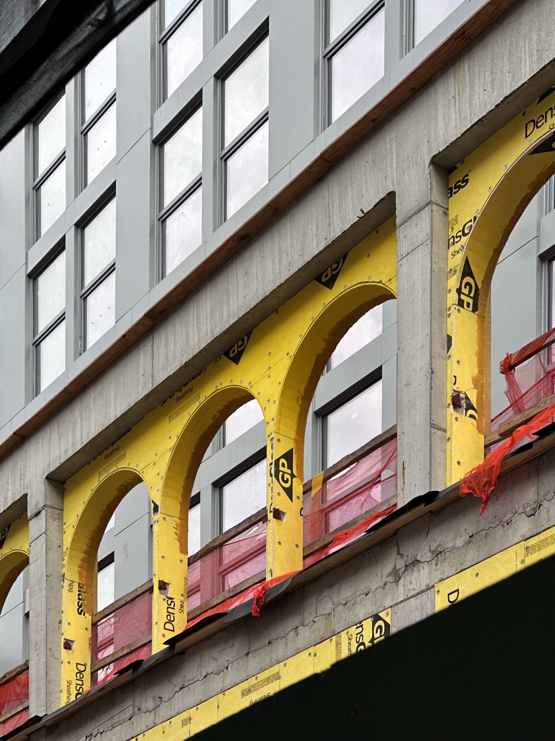
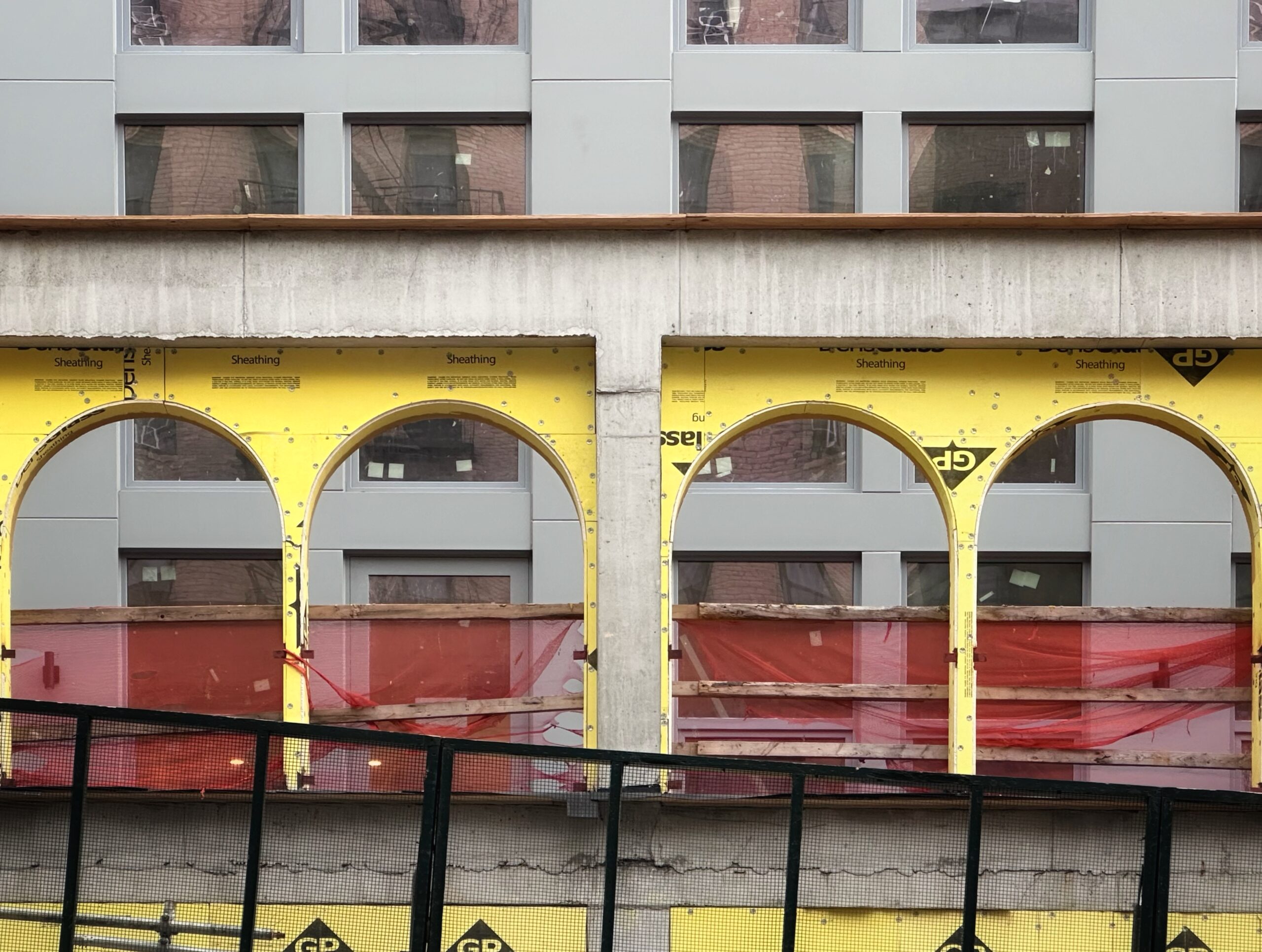
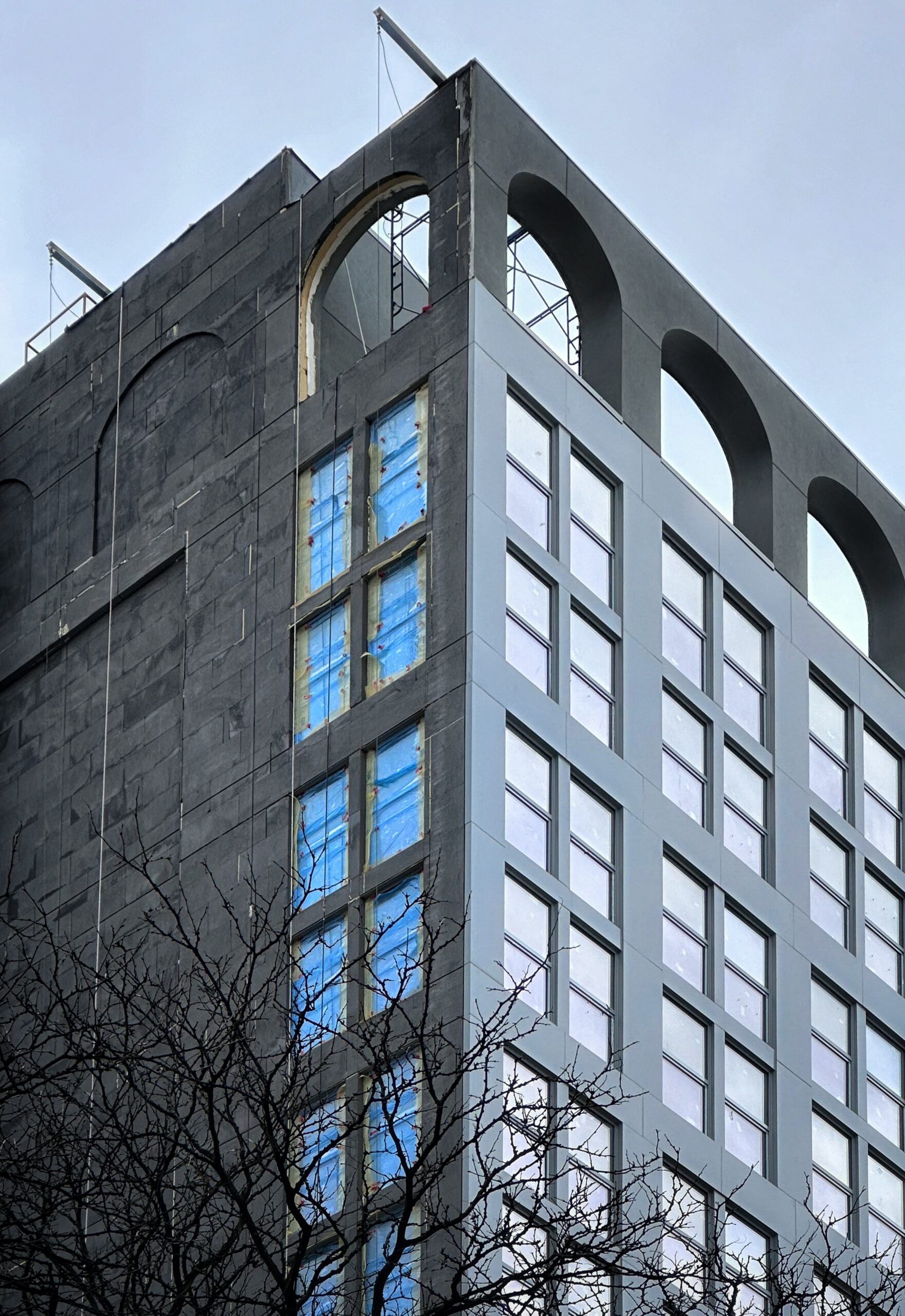
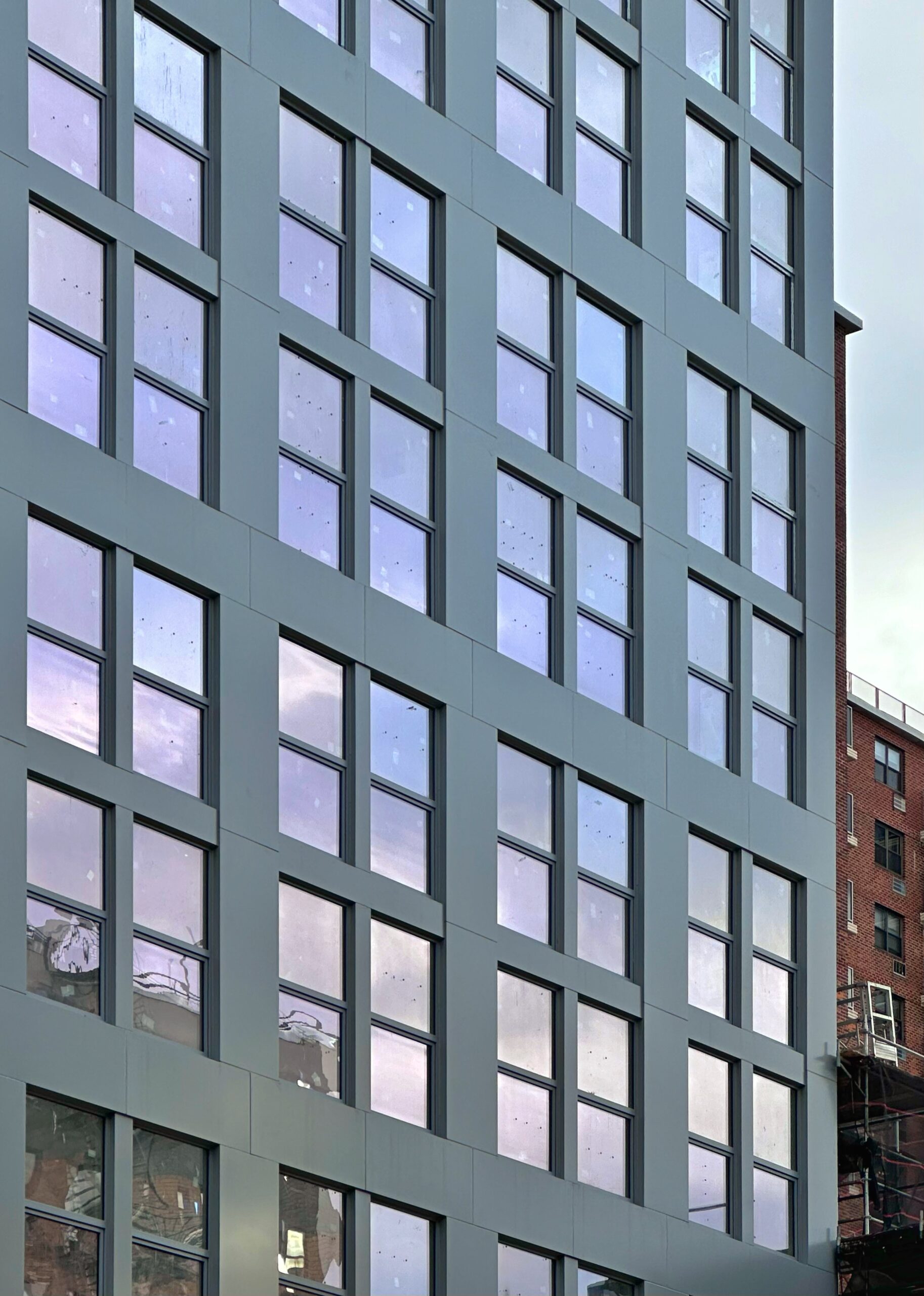
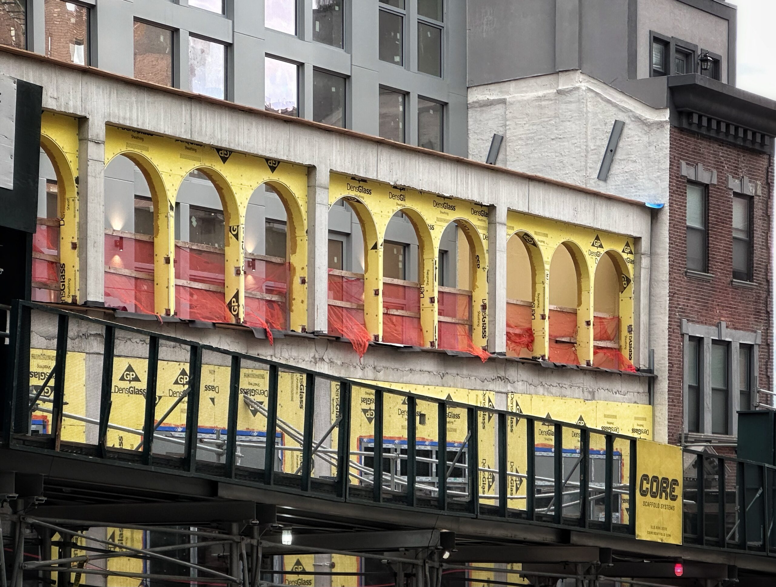
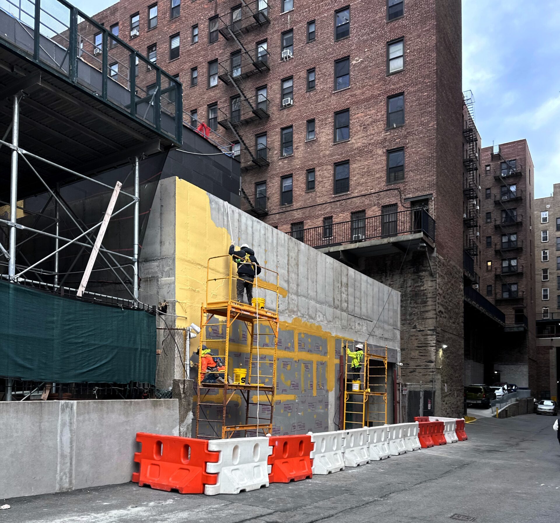
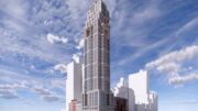
The reinforced concrete superstructure stands topped out and is being clad in gray paneling around the installed grid of double-hung windows. The main northern elevation facing West 158th Street is almost fully enclosed with the exception of the podium levels, which feature a series of arched cutouts, matching the motif used at the top of the building. Crews are also finishing installing the envelope of charcoal-hued panels on the mostly blank western face.
636 West 158th Street. Photo by Michael Young.
636 West 158th Street. Photo by Michael Young.
636 West 158th Street. Photo by Michael Young.
636 West 158th Street. Photo by Michael Young.
636 West 158th Street. Photo by Michael Young.
636 West 158th Street. Photo by Michael Young.
636 West 158th Street. Photo by Michael Young.
636 West 158th Street. Photo by Michael Young.
636 West 158th Street. Photo by Michael Young.
636 West 158th Street. Photo by Michael Young.
636 West 158th Street. Photo by Michael Young.
636 West 158th Street. Photo by Michael Young.
The following photos show what appears to be a small annex along a side road on the western end of the property. While the purpose of this extension is unclear, it could potentially serve as the entrance to the facility’s parking garage.
636 West 158th Street. Photo by Michael Young.
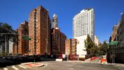
The property was formerly occupied by a row of six low-rise residential buildings, as seen in the below Google Street View image from before their demolition.
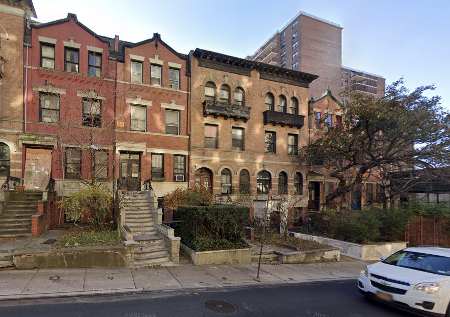
636-646 West 158th Street in Washington Heights, Manhattan via Google Maps
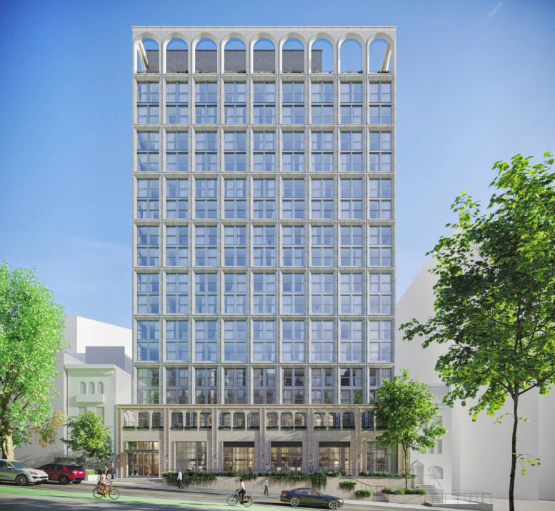
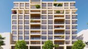
The rendering in the main photo appears outdated based on the observed outcome. The illustration depicts the northern elevation with light gray brick forming a two-story grid around a façade of floor-to-ceiling windows, rather than the actual fenestration, which utilizes punched windows surrounded by gray paneling. However, the image still provides an indication of the new tower’s presence within the neighborhood.
The nearest subway from the ground-up development is the 1 train at the 157th Street station to the east along Broadway.
636 East 158th Street’s initial anticipated completion date was December 26, 2025, as noted on the outdated info board. YIMBY expects works to conclude sometime in the latter half of this year.
Subscribe to YIMBY’s daily e-mail
![]()
Follow YIMBYgram for real-time photo updates
Like YIMBY on Facebook
Follow YIMBY’s Twitter for the latest in YIMBYnews
That looks heavily value engineered.
Well, it’s terrible, and like I said earlier it would be much less terrible (and easier to disappear) from the street had the base height competently met the height of the old townhouse neighbors.
Just terrible design all around.
Thanks NYC zoning!!!
I’ll throw in a barf for good measure.
Glad they at least included the arches…
What’s really scary here is that not even one of New York’s best architects could make this look right working within the DOB zoning formula. A child could look at that street and know the base of this building should match the height of the flanking structures’ cornice line.
It just shows you how flawed and need of updating the current zoning massing and sky-plane formulas are. 1961 was a long time ago, an update is way overdue. 45 years were between 1916 and 1961. By that metric New York City should have revamped the code in 2006, which would have been an ideal time period considering how much streetwall damaging development has occurred since then. Just walk the the West 30’s and imagine the difference that would have made in the last 20 years. And the damage is still being done. Wake up DOB.
What do we have to do to change this? I was a Hippie. I’m ready for a movement.
I’m going to assume that the cost increased and the developer didn’t have enough room in the budget to make the design happen. This is Morris Adjmi Architects worst design to date. They are a firm that does incredible work, therefore, it’s sad to see the neighborhood not get the final product.
Terrible that they eliminated the original Leo townhouses, the first that were built in Audubon Park at the turn of the last century. The small “garage entrance” immediately to the west was originally John James Audubon’s “Minniesland” carriage way.
I keep looking at the tower facade and thinking, this can’t be the finished product. These are insulation panels, of something. This is a horrible nightmare, especially considering the beautiful torn down townhouses that should have been landmarked.
I’m still in shock just how bad this is. Zoning policies in this town are a complete disaster made worse by cheapass developers with no pride.
The McDonalds at the base of the structure matches the one on top but they forgot to paint it yellow.
Jeez. It totally doesn’t fit at all. But my real complaint, is who was looking at the site plan?
You put a 17 story building in the middle of everything else and essentially create the appearance that the entire structure simply decided to set itself back from the lot line matching the other town houses. Pretty ugly.
Too bad.
Man, even the greats get value-engineered