
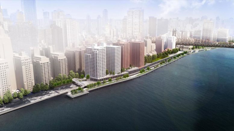
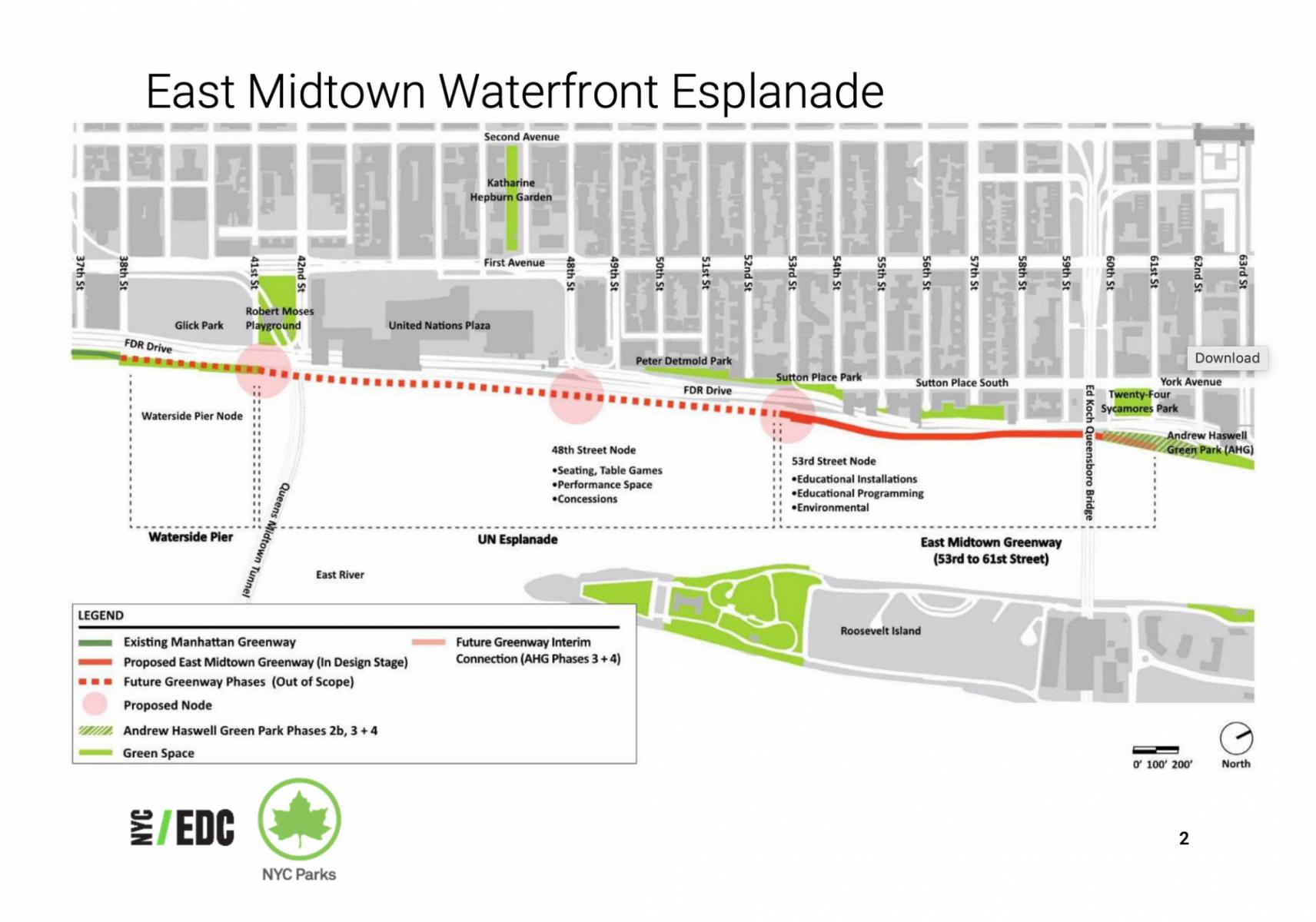
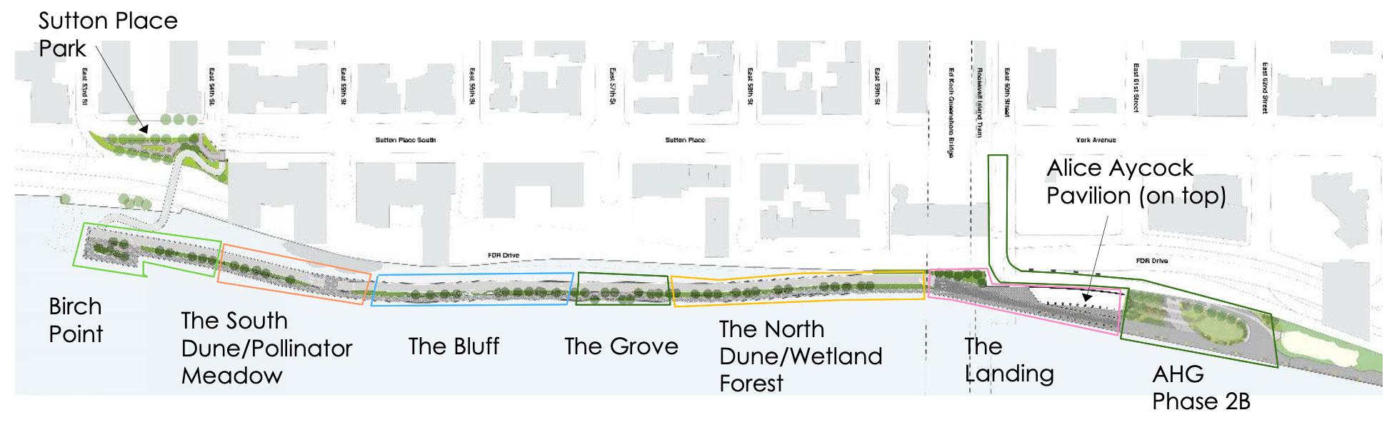
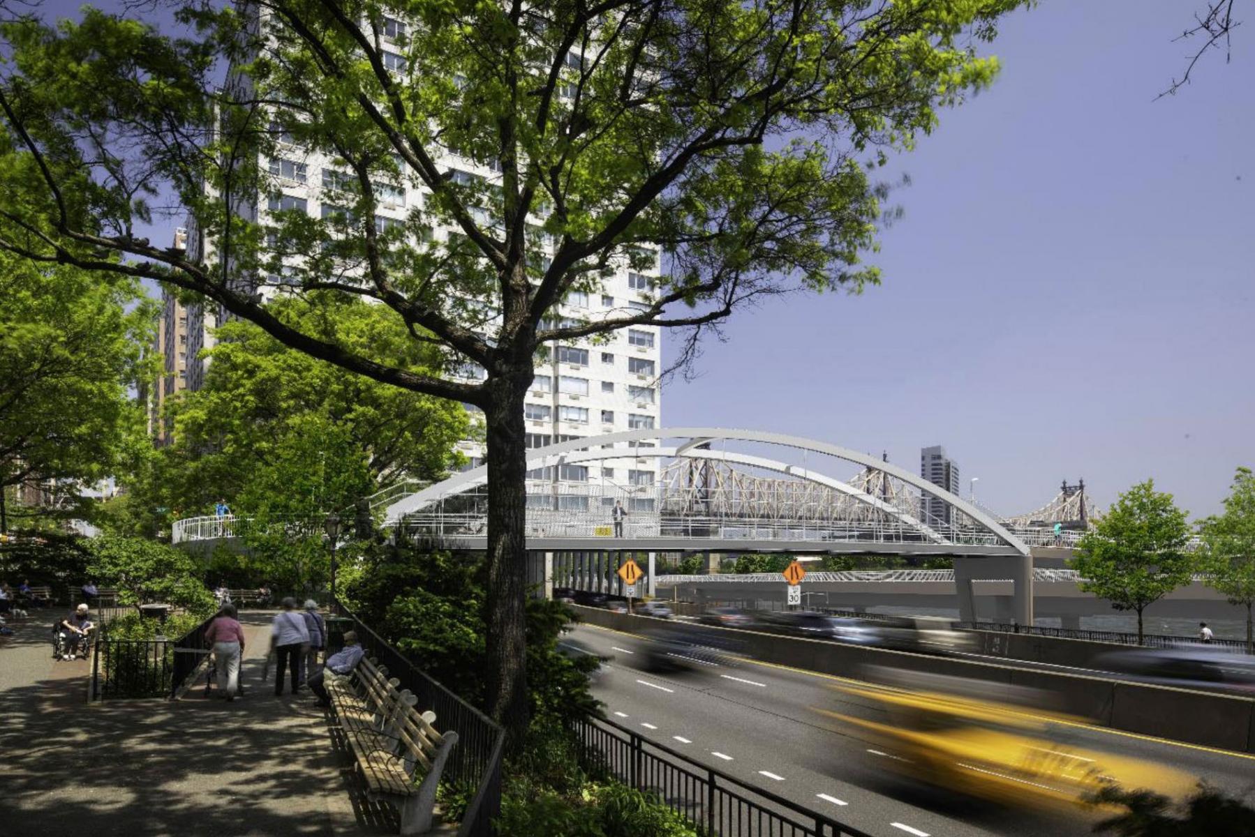
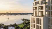
Construction is ongoing on the first phase of the $100 million East Midtown Greenway, a three-segment reimagining of the East Midtown Waterfront esplanade in Sutton Place between East 38th to East 61st Streets. Photographs below focus on the northernmost part of the scheme, which will span between East 53rd and East 61st Streets in Midtown, Manhattan. This part will include a new park entrance at East 60th Street, a pedestrian bridge, and the revamping of Andrew Haswell Green Park and the Alice Aycock Pavilion. The overall master plan aims to create new green space for pedestrian and bicyclists and provide safer access to the eastern edge of the island, which had been largely impeded by the FDR Drive.
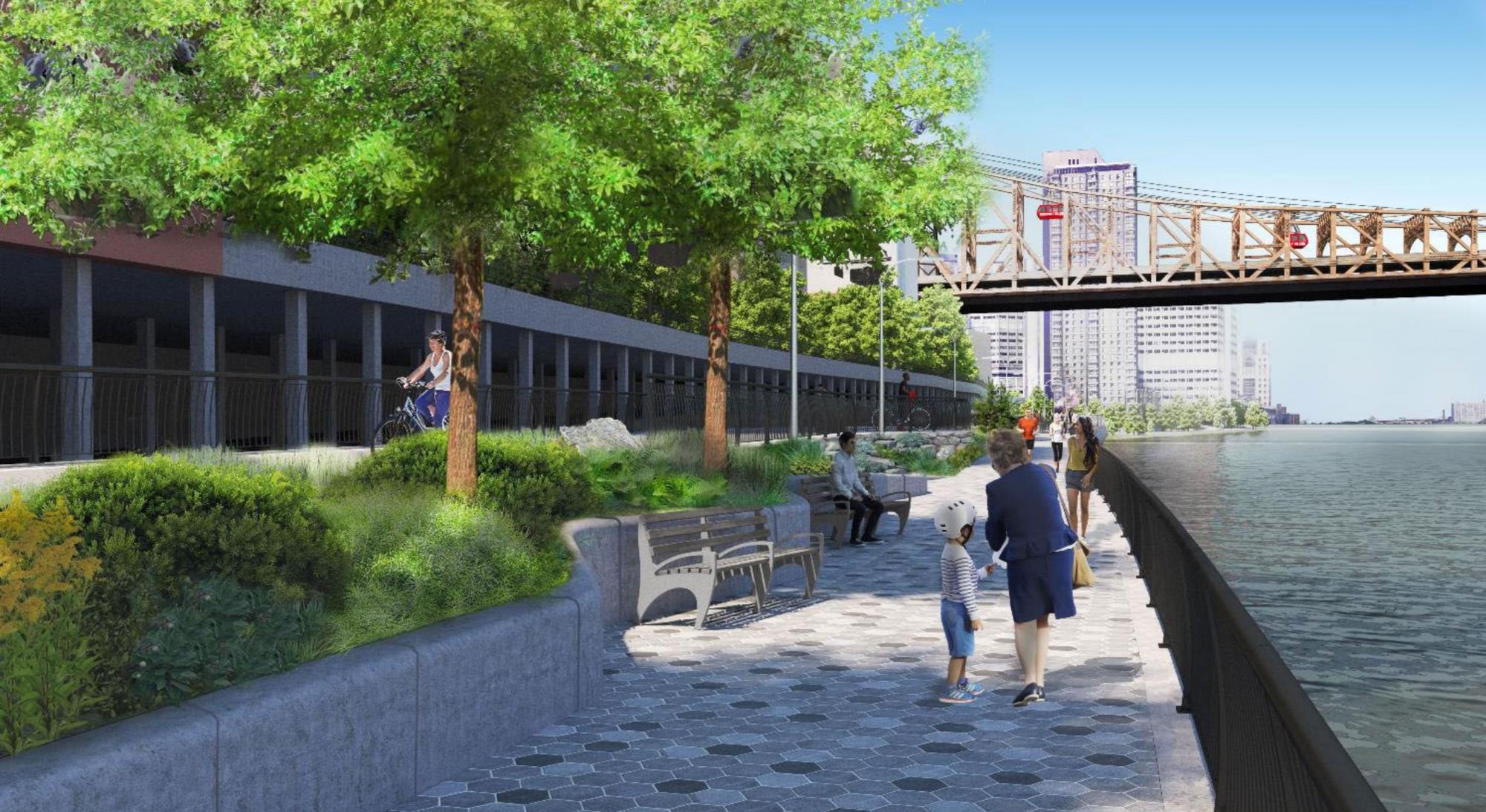
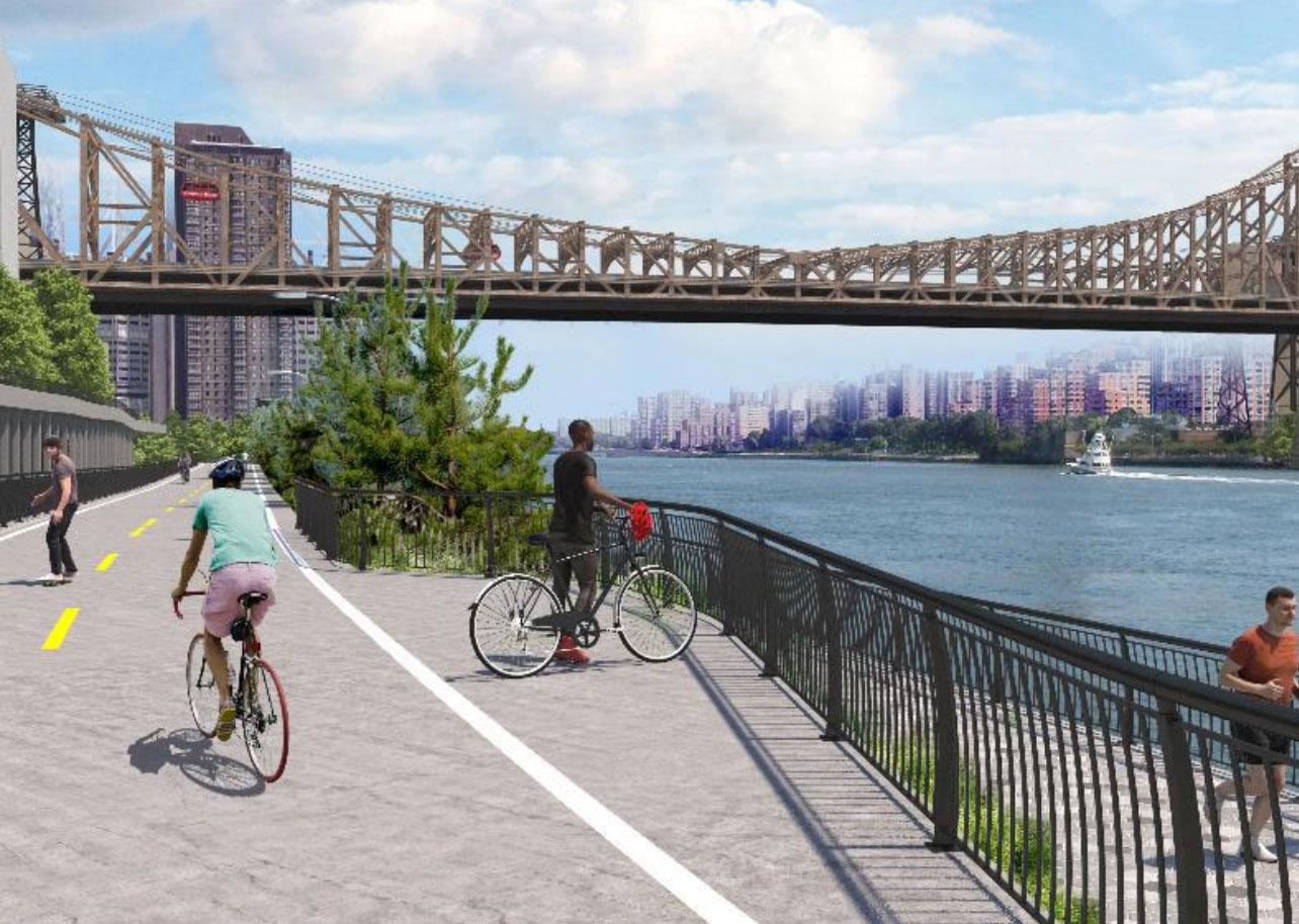
Several renderings below were released last year from the NYC Economic Development Corporation and show how the park space will soon look, as well as the much grander perspective of the green infrastructure stretching further south to East 38th Street at a later unspecified date.
Rendering courtesy of the NYC Economic Development Corporation
The East Midtown Greenway. Courtesy of the NYC Economic Development Corporation
A closer look at the East 54th Street bridge at the southern end of the East Midtown Greenway. Courtesy of the NYC Economic Development Corporation
Rendering courtesy of the NYC Economic Development Corporation
Rendering courtesy of the NYC Economic Development Corporation
Rendering courtesy of the NYC Economic Development Corporation
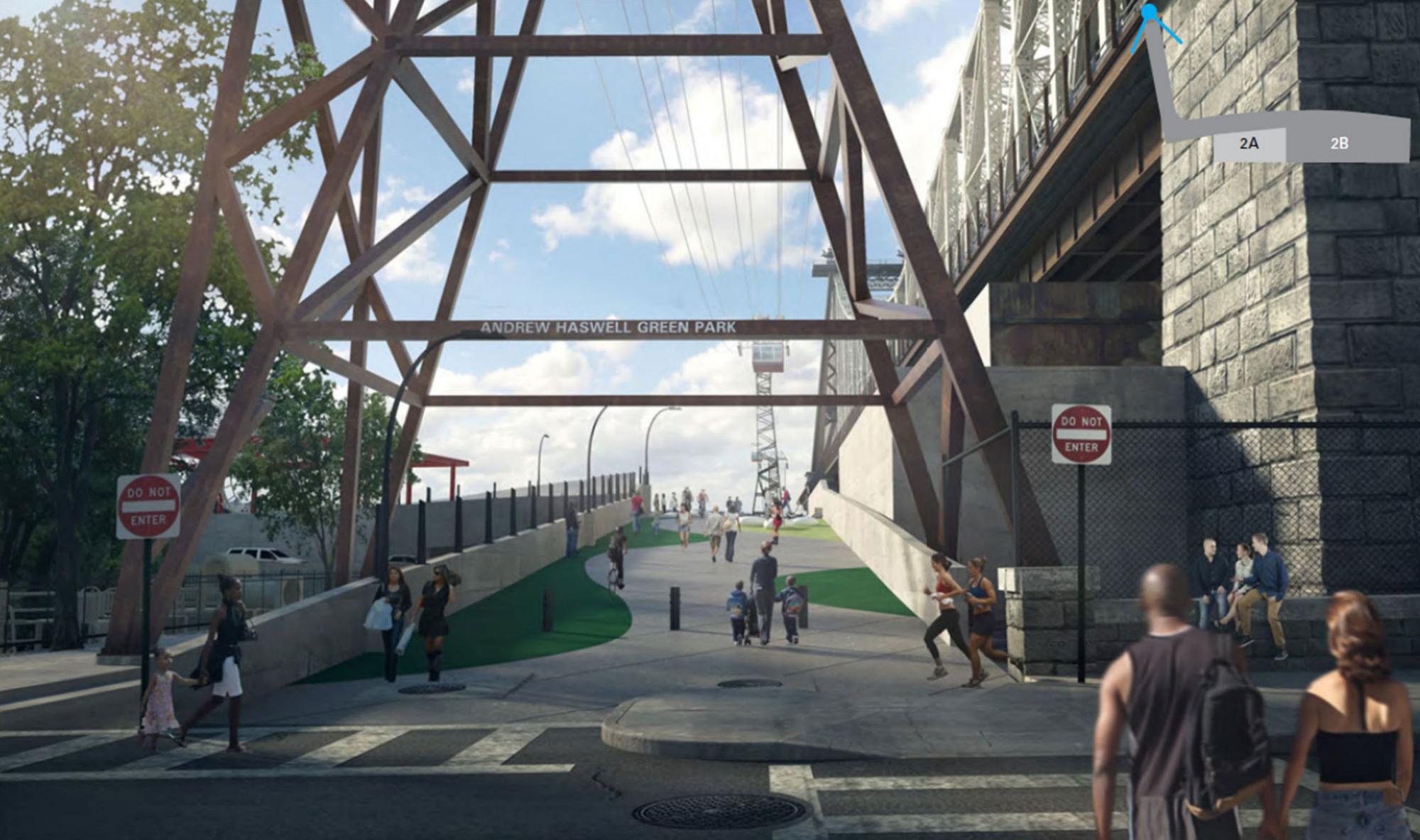
The entry to the entrance to the Andrew Haswell Green Park on the northern end of the East Midtown Greenway. Rendering courtesy of the NYC Economic Development Corporation
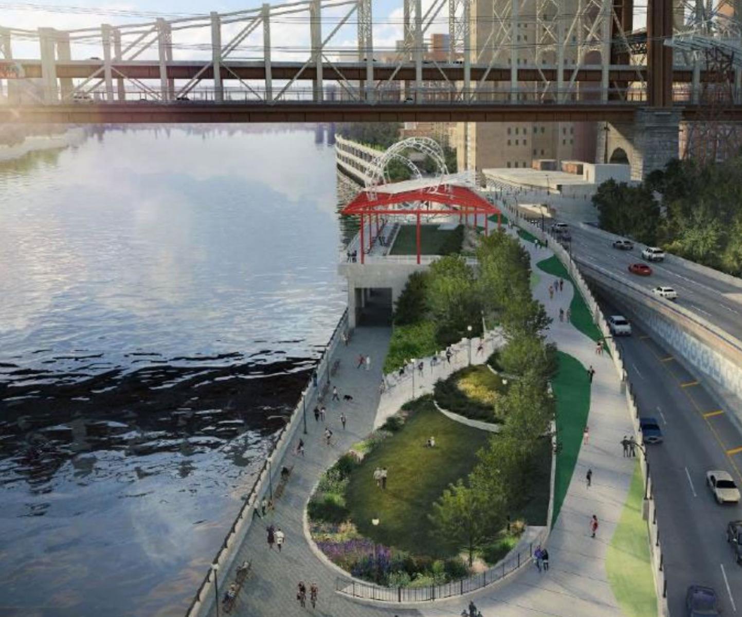
The Alice Aycock Pavilion and the northern end of the East Midtown Greenway. Rendering courtesy of the NYC Economic Development Corporation
The best vantage point to see the whole East Midtown Greenway is from Roosevelt Island.
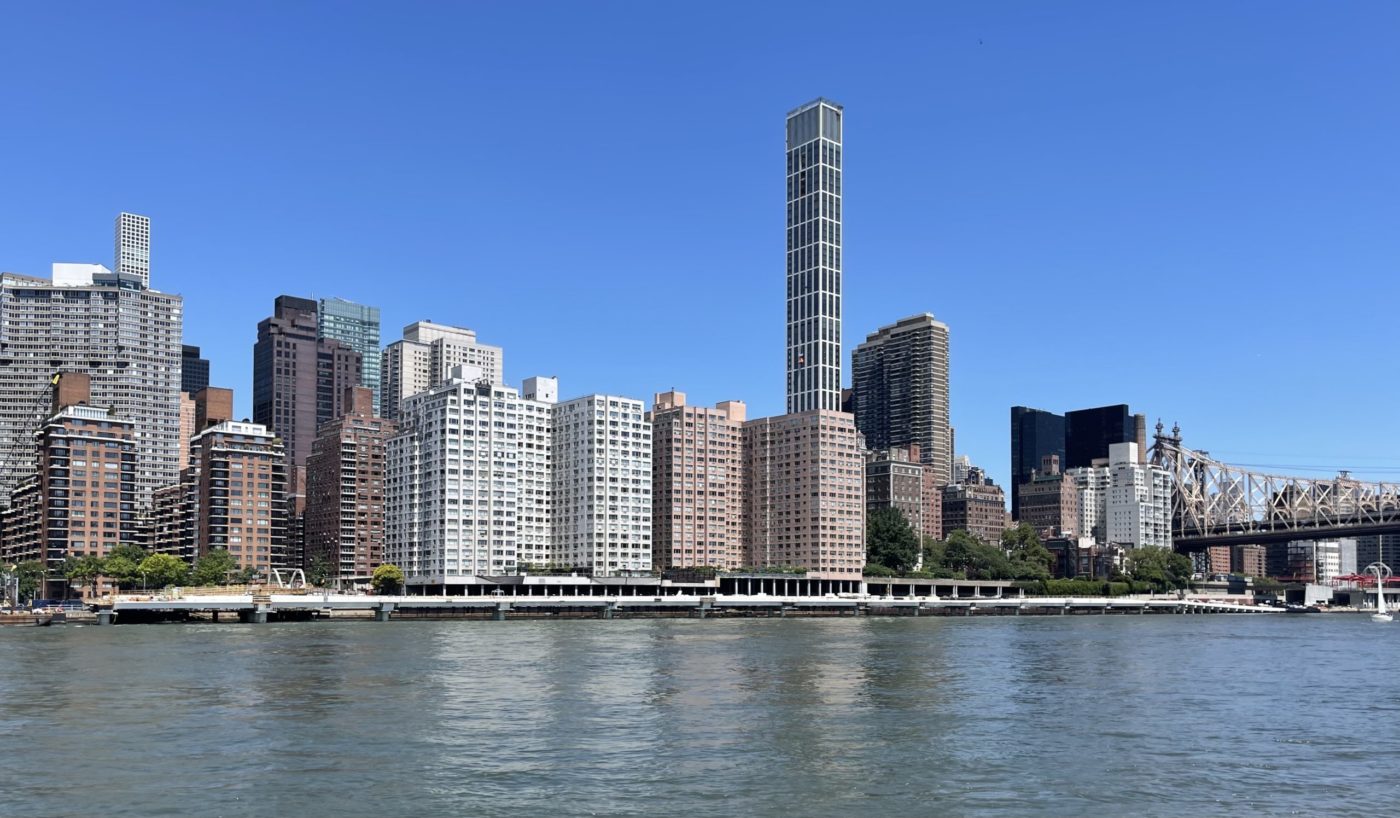
Photo by Michael Young
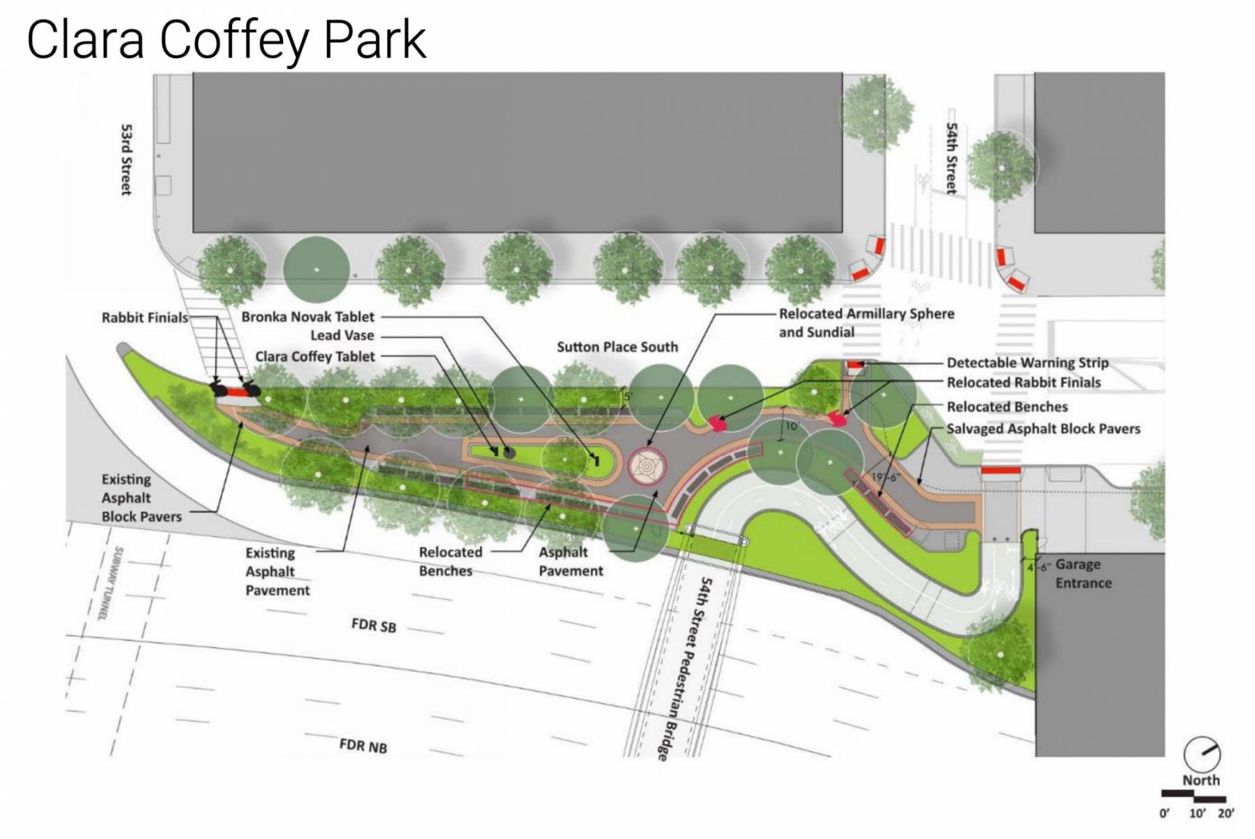
Here we can see the new bridge, designed by Stantec, nearing completion and connecting the esplanade to Sutton Place Park South along East 54th Street. Plans were first announced in 2019 and early work on the bridge’s foundations temporarily closed Clara Coffey Park but reopened last fall, while also rerouting existing sewer lines.
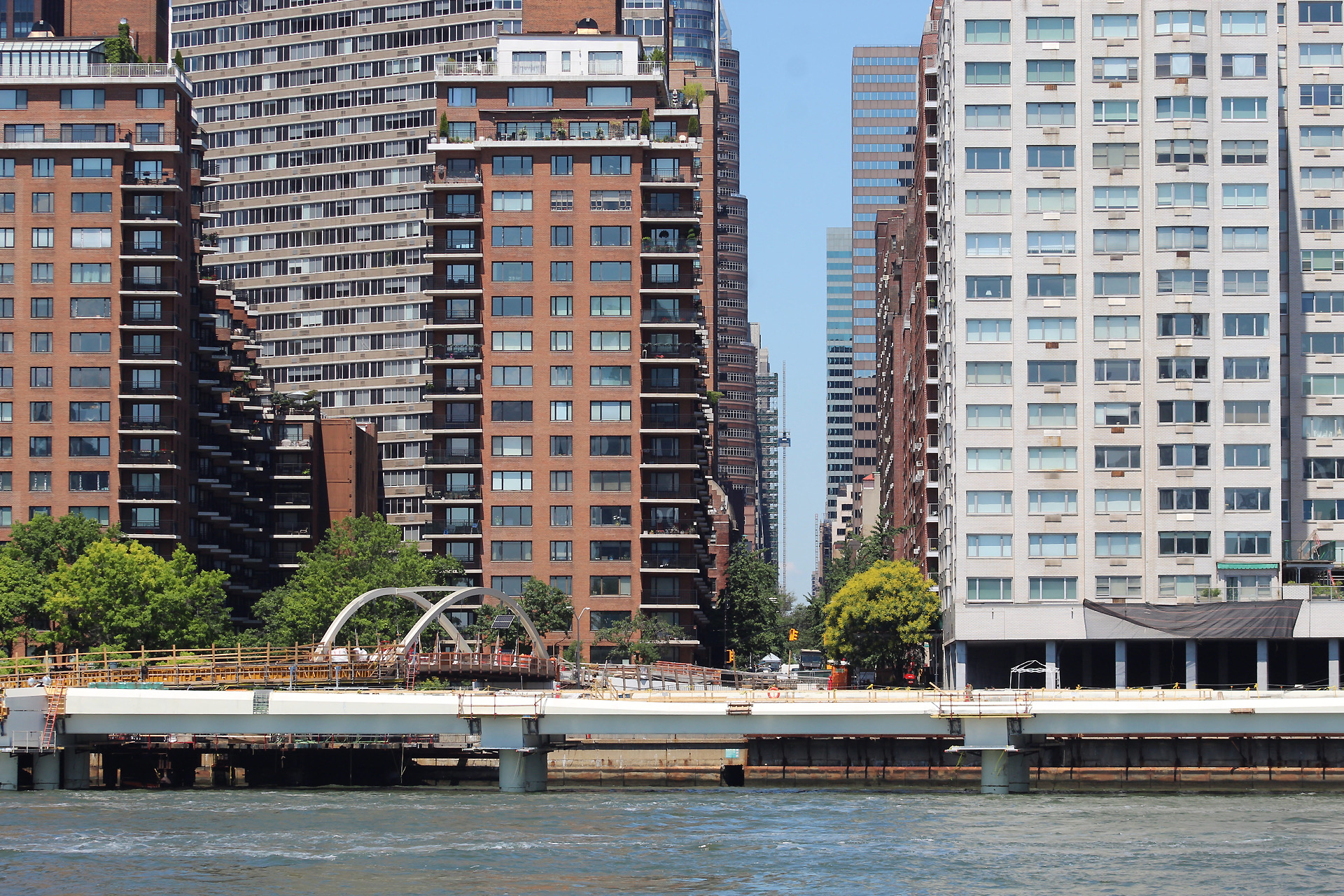
Photo by Michael Young
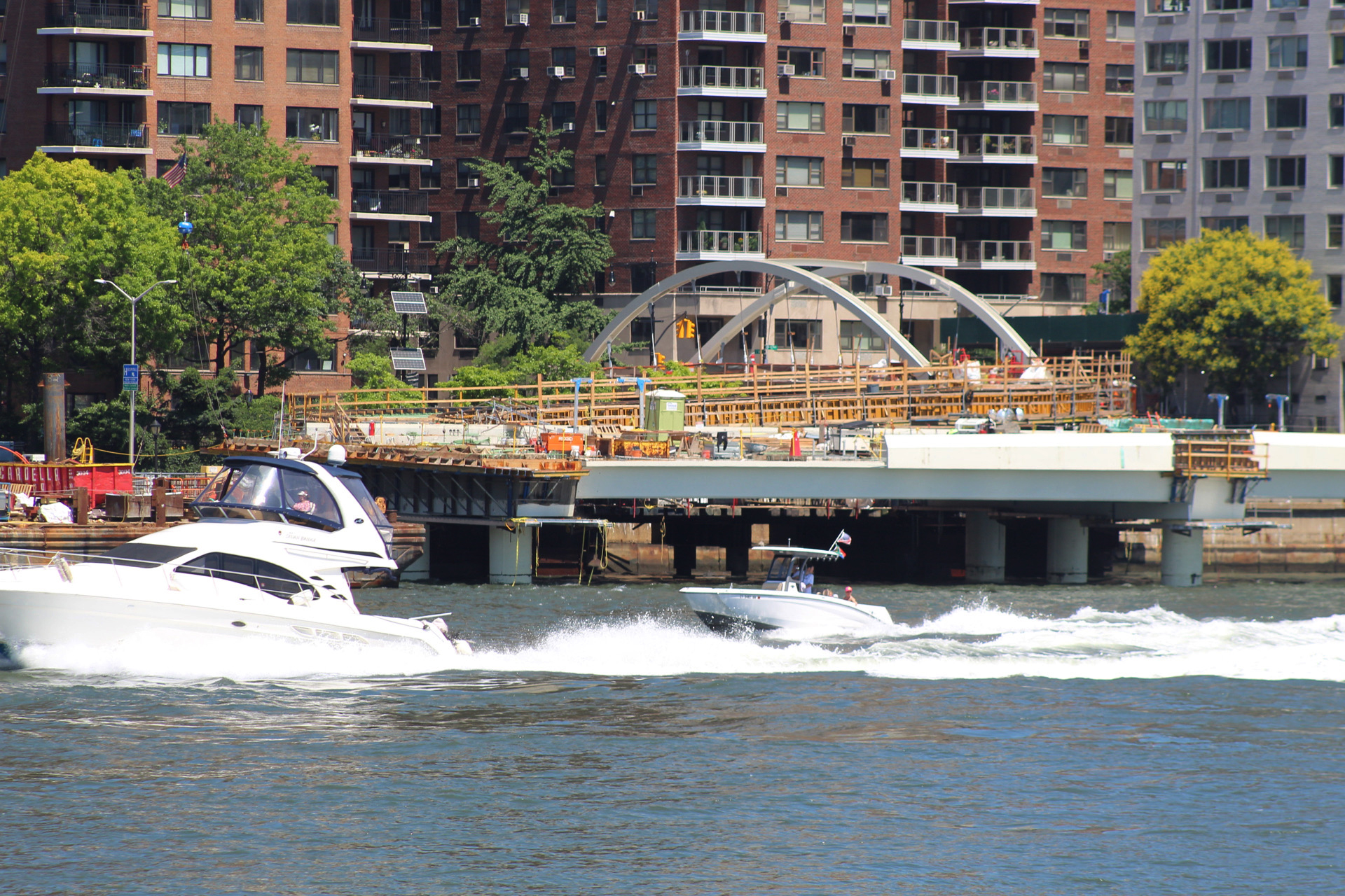
Photo by Michael Young
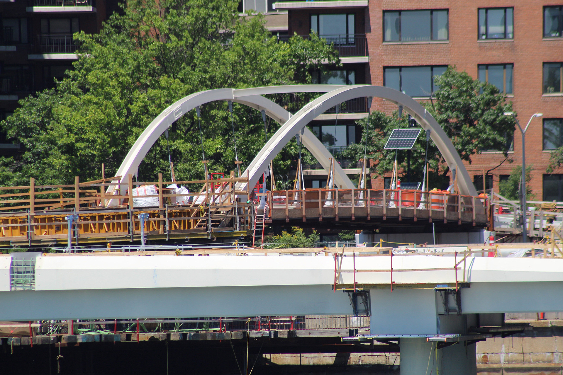
Photo by Michael Young
Below are photographs of the pedestrian walkway under construction in September that give us an early look at the columns that rise from the waters before the platforms were placed directly over.
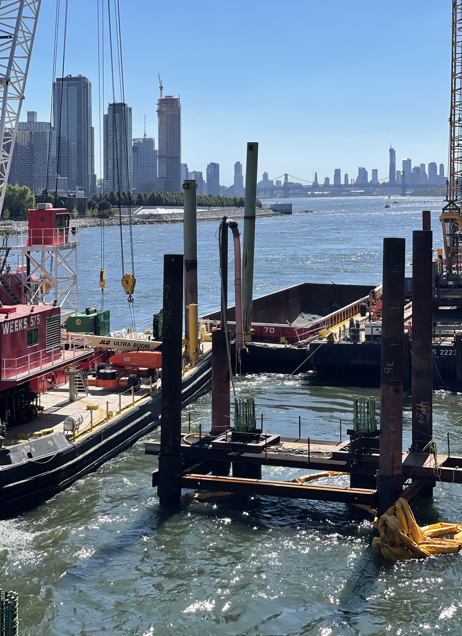
Photo by Michael Young
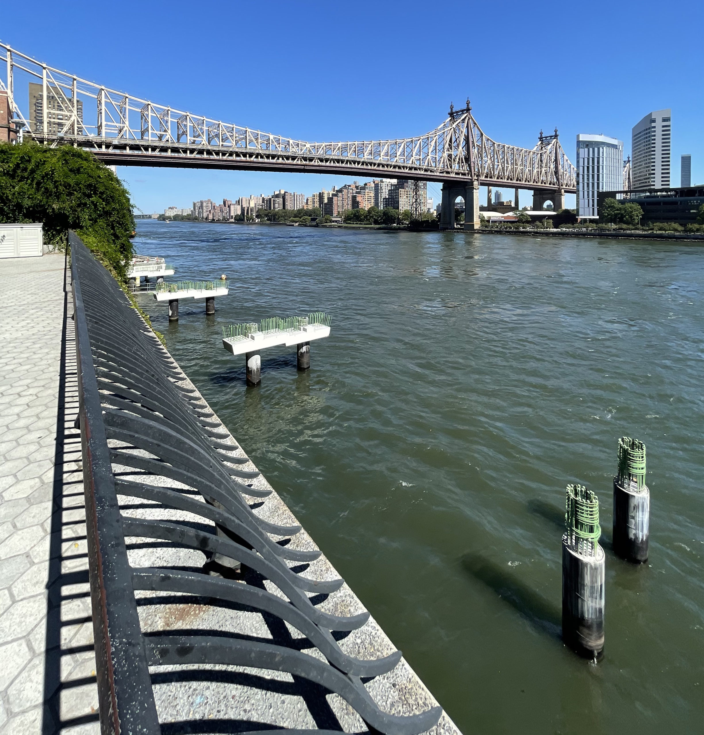
Photo by Michael Young
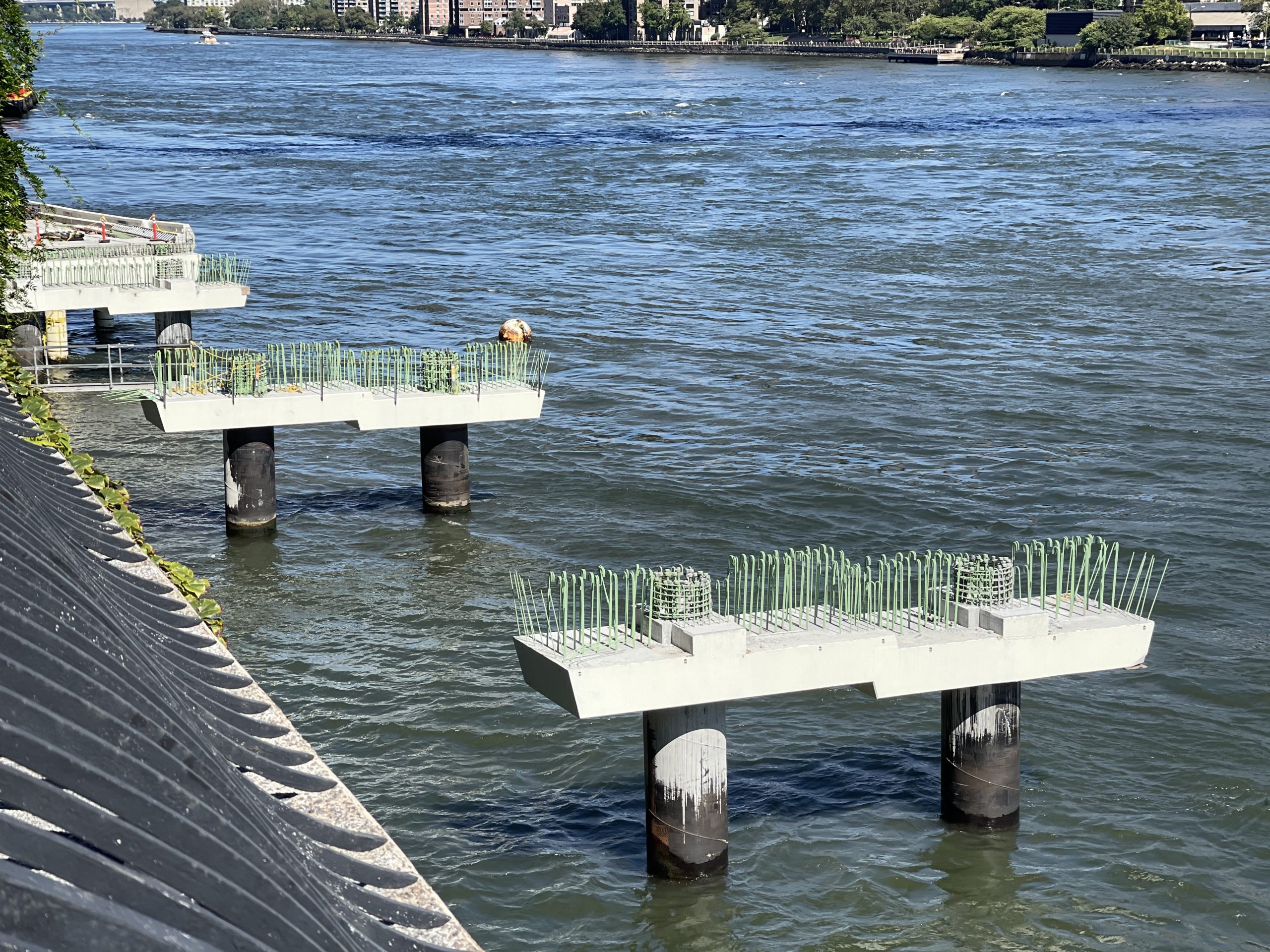
Photo by Michael Young
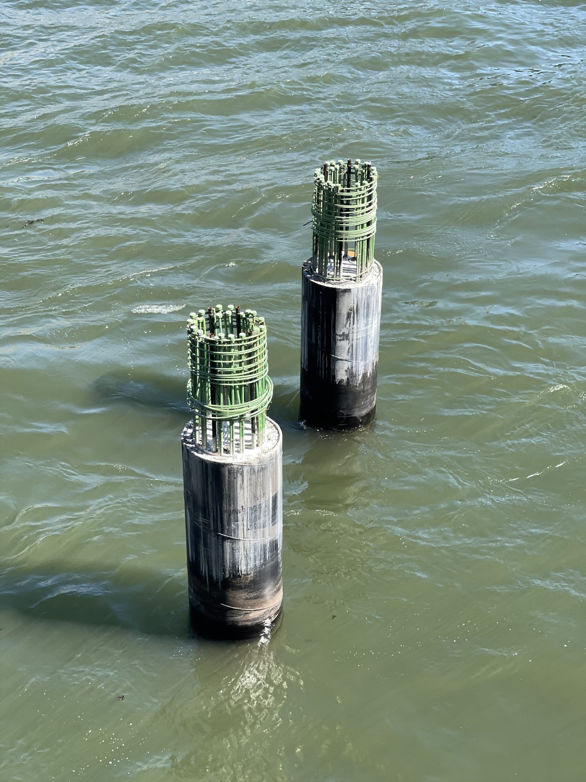
Photo by Michael Young
The East Midtown Greenway has been underway for the past several years and restarted in October 2020. It is reported to be completed in the fall of 2023, bringing the vision of a continuous 32-mile loop around Manhattan closer to reality.
Subscribe to YIMBY’s daily e-mail
![]()
Follow YIMBYgram for real-time photo updates
Like YIMBY on Facebook
Follow YIMBY’s Twitter for the latest in YIMBYnews


Now if they could only prevent the existing Greenway north of 61at street from falling into the east river, we may have a decent waterfront on the east side.
This looks wonderful. However, I wonder how much more it would cost to build public & private land on top of the FDR? It’s not a new concept. It has been done in several locations along the FDR such as Carl Schurz Park, the neighborhood of Sutton place and most recently Rockefeller University. The latter had prefabricated modular segments created and installed over the FDR, providing them with 2 acres of land to build on. On top of that, these modular segments were installed without the need to completely shut down the FDR. Rockefeller University had to purchase air rights to do this, which means the city made money. In addition, there are taxes being paid on the structures built on top. It’s the same with Sutton Place. The eastern half of the neighborhood sits on top of the FDR. The city is making money from taxes being paid on this new land. In short, I question why we are building out into the river with public money (no revenue), when we could be creating more land and revenue by building on top of an eyesore, viewed as a barrier that limits access to the East river. Take a look at what’s going on along the river in Brooklyn and Queens. They are lucky. They don’t have a highway to deal with. So it’s easy for them. Anyway, food for thought.
I agree that the expansion is wonderful. However, building a public park over the FDR would not generate tax revenue. I don’t know anything about the alternatives that were considered. Most likely the determining factor was the cost of the project and the future costs associated with maintaining the integrity of the structure over the FDR.
Haha. I did not suggest public land only. It should be done as both private and public endeavors, like the examples I mentioned in my first comment. Both are generating revenue for the city everyday.
The portion that they are currently building is adjacent to the Sutton Place block that was already built over the FDR. I guess nothing is precluding them from doing the same for 49, 50, 51, and 52 streets. Good luck fighting that zoning battle, though. Beekman Place is home to some wealthy people who will not be happy losing their river views.
In my opinion, the FDR should be covered when below the adjacent grade, dropped from the elevated structure when above grade, and turned into an urban boulevard when it is at grade to adjacent streets. The latter is especially true in East Harlem where the FDR effectively has a service road. If you turn it into something similar to West Street it would not only reduce noise, but make space for much better integration of the city into the waterfront. Also remove the elevated section from Jackson Street to the battery, restore south street, and turn the extra lane into a larger linear park (just like the west side!)
it will never happen of course, but one can dream.